Sun
Planets and Moons
ID: 12458
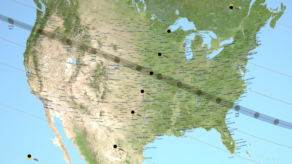
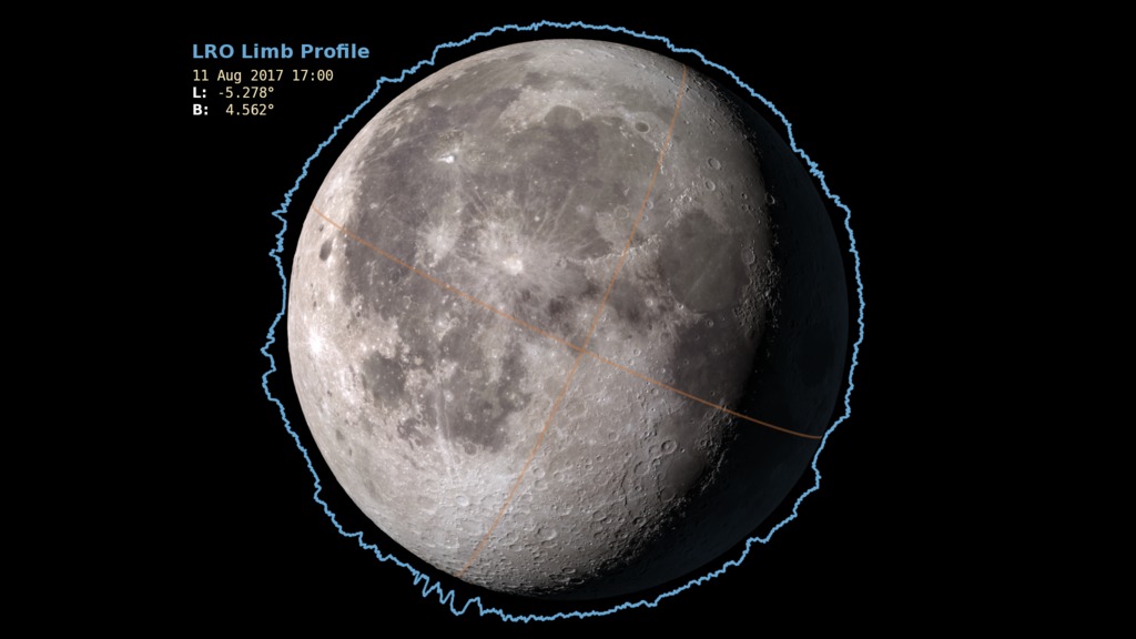
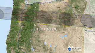
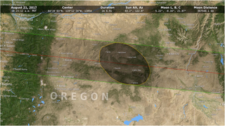
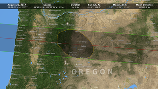
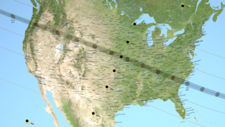
On August 21, 2017, the moon will pass between Earth and the sun in a total solar eclipse that will be visible on a path from Oregon to South Carolina across the continental United States. This path of totality will occur in a little over 90 minutes, while observers on the ground will see the eclipse for about two and a half minutes. Standing at the edge of the moon's shadow, or umbra, the difference between seeing a total eclipse and a partial eclipse comes down to elevation - mountains and valleys both on Earth and on the moon - which affect where the shadow lands. In this visualization, data from NASA's Lunar Reconnaissance Orbiter account for the moon's terrain that creates a jagged edge on its shadow. This data is then combined with elevation data on Earth as well as information on the sun angle to create the most accurate map of the eclipse path to date. Watch the video to learn more.
All State maps are available at: NASA's official eclipse 2017 website

Shadow of the Eclipse
All State maps are available at: NASA's official eclipse 2017 website
Source Material
Story Credits
Lead Visualizer/Animator:
Ernie Wright (USRA)
Lead Producer:
Genna Duberstein (USRA)
Lead Scientist:
C. Alex Young (NASA/GSFC)
Lead Writer:
Ellen T. Gray (ADNET Systems, Inc.)
Ernie Wright (USRA)
Lead Producer:
Genna Duberstein (USRA)
Lead Scientist:
C. Alex Young (NASA/GSFC)
Lead Writer:
Ellen T. Gray (ADNET Systems, Inc.)
Please give credit for this item to:
NASA/Goddard Space Flight Center Scientific Visualization Studio
NASA/Goddard Space Flight Center Scientific Visualization Studio
Short URL to share this page:
https://svs.gsfc.nasa.gov/12458
Keywords:
SVS >> HDTV
SVS >> App
NASA Science >> Sun
NASA Science >> Planets and Moons
https://svs.gsfc.nasa.gov/12458
Keywords:
SVS >> HDTV
SVS >> App
NASA Science >> Sun
NASA Science >> Planets and Moons


