Earth
ID: 11904
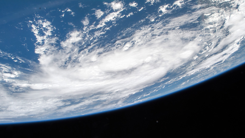
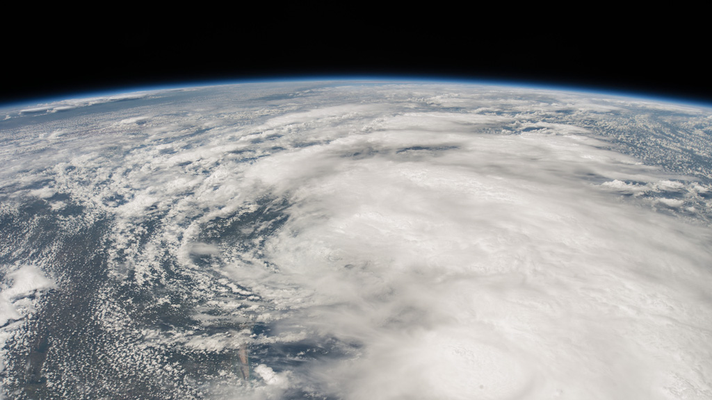
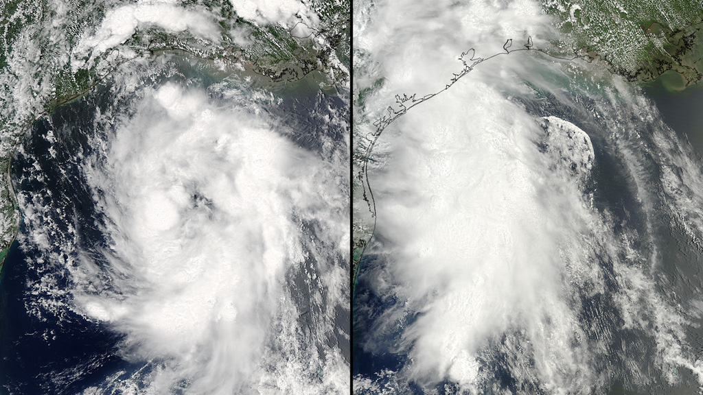
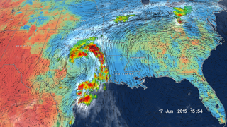
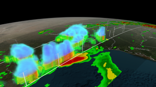
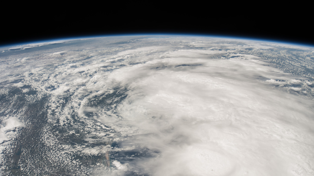
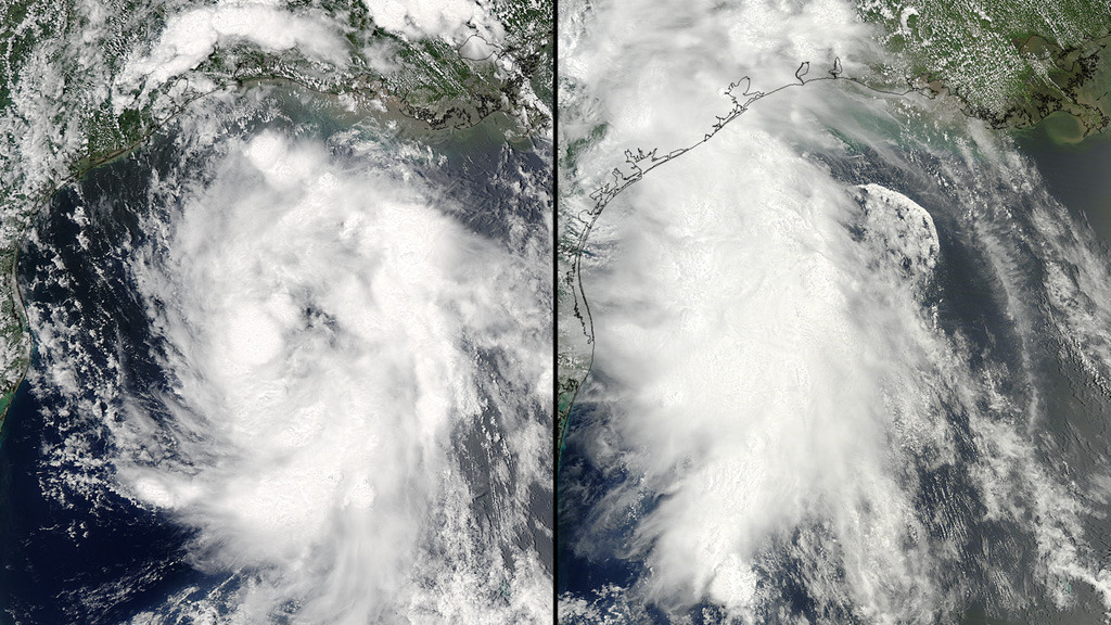
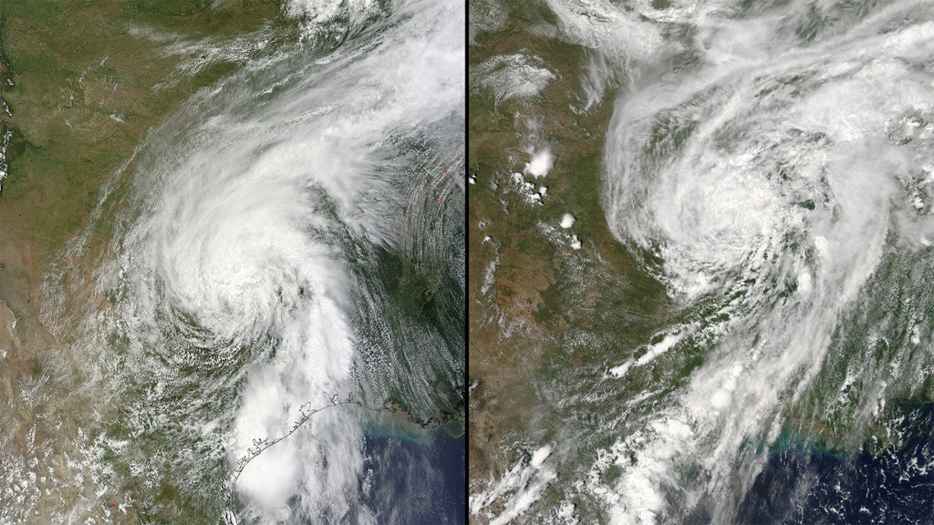
Although scientists predict 2015 will be a quiet year for Atlantic hurricanes, two storms have already been given names this season. The latest, Bill, was classified as a tropical storm when it made landfall over southeastern Texas on June 16, 2015. The storm produced high winds and heavy rains that triggered severe floods in parts of Texas and Oklahoma. From Earth orbit, astronauts aboard the International Space Station and NASA satellites captured images of the storm as it developed over the Gulf of Mexico, crossed onto land and traveled east over the United States. NASA’s GPM Core Observatory satellite also collected data of the storm’s rainfall rates. The data was combined with measurements from other satellites to estimate the storm’s accumulated rainfall and determine which areas were hit the hardest. Watch the video to see GPM’s view of the storm on June 17, 2015.

Tropical Storm Bill
Related Stories
Story Credits
Lead Visualizer/Animator:
Alex Kekesi (Global Science and Technology, Inc.)
Visualizer/Animator:
Greg Shirah (NASA/GSFC)
Producers:
Rani Gran (NASA/GSFC)
Ryan Fitzgibbons (USRA)
Scientists:
Gail Skofronick Jackson (NASA/GSFC)
Dalia B Kirschbaum (NASA/GSFC)
Lead Writer:
Kayvon Sharghi (USRA)
Alex Kekesi (Global Science and Technology, Inc.)
Visualizer/Animator:
Greg Shirah (NASA/GSFC)
Producers:
Rani Gran (NASA/GSFC)
Ryan Fitzgibbons (USRA)
Scientists:
Gail Skofronick Jackson (NASA/GSFC)
Dalia B Kirschbaum (NASA/GSFC)
Lead Writer:
Kayvon Sharghi (USRA)
Please give credit for this item to:
NASA's Goddard Space Flight Center
Cover image courtesy of NASA
International Space Station image courtesy of NASA
Satellite images courtesy of NASA/GSFC/MODIS Rapid Response
NASA's Goddard Space Flight Center
Cover image courtesy of NASA
International Space Station image courtesy of NASA
Satellite images courtesy of NASA/GSFC/MODIS Rapid Response
Short URL to share this page:
https://svs.gsfc.nasa.gov/11904
Keywords:
SVS >> App
NASA Science >> Earth
https://svs.gsfc.nasa.gov/11904
Keywords:
SVS >> App
NASA Science >> Earth


