Earth
ID: 11757

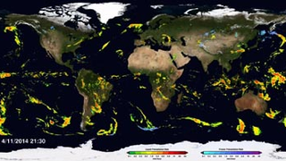
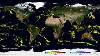
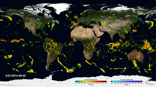
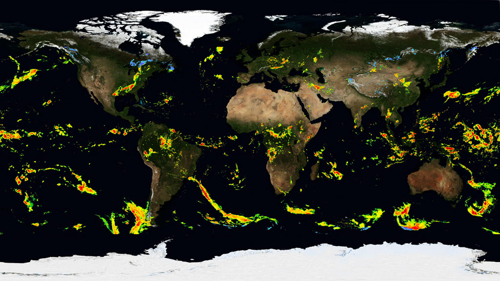
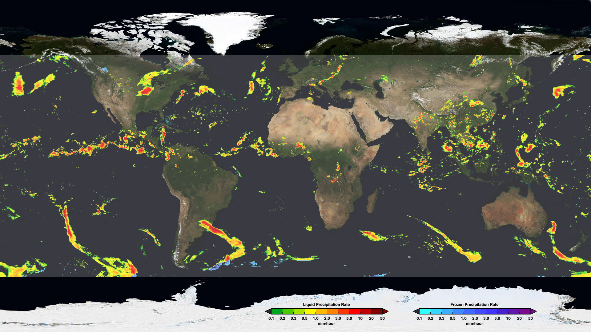
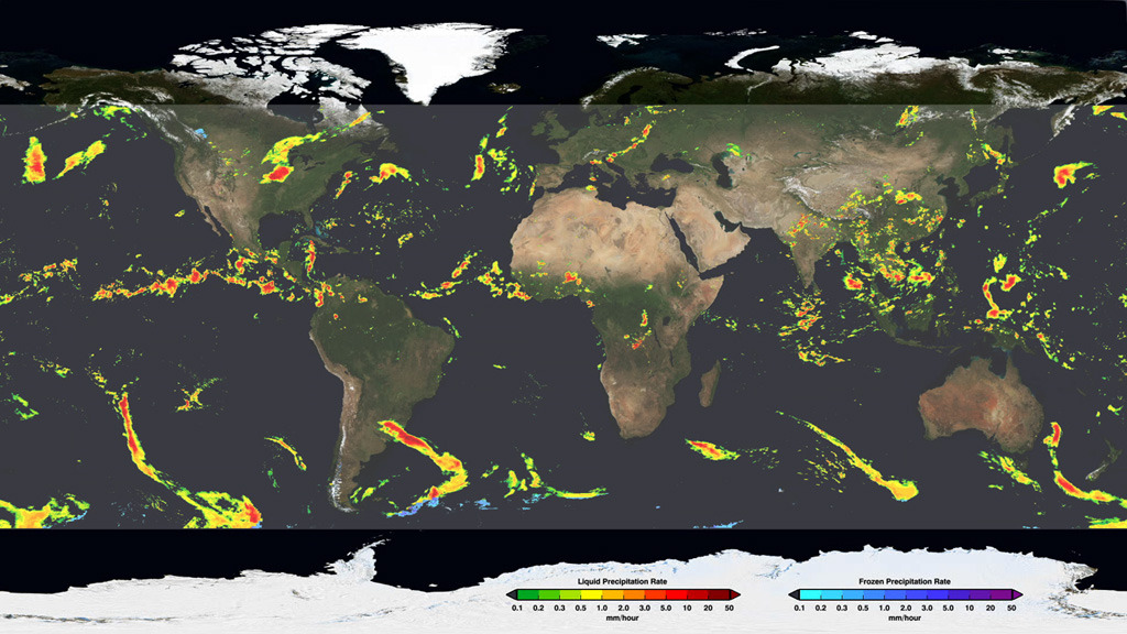
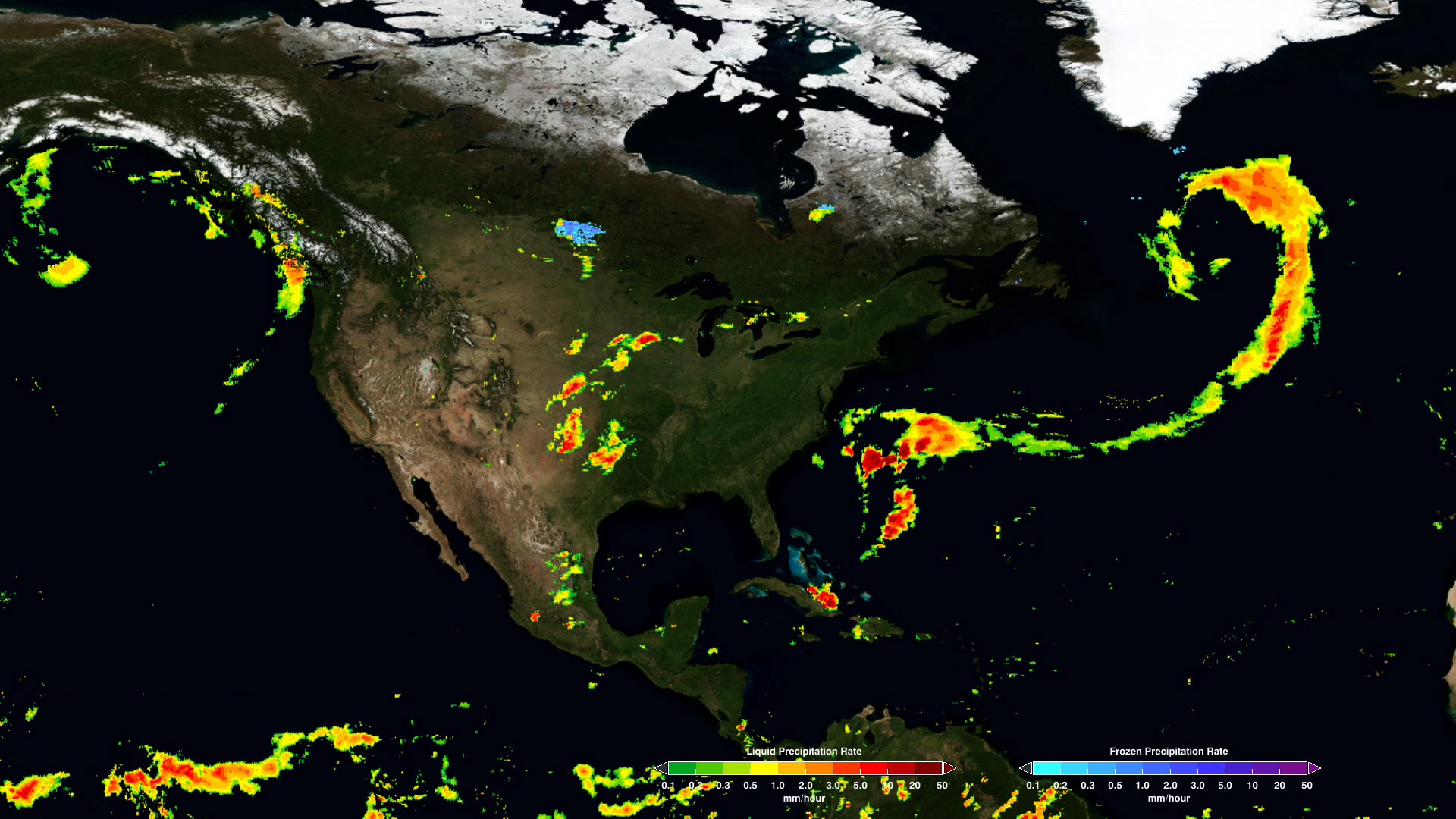
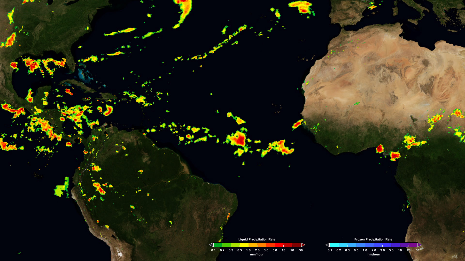
A new data set produced by NASA and the Japan Aerospace Exploration Agency’s Global Precipitation Measurement (GPM) mission is providing scientists with the most complete look at rainfall and snowfall to date. Called IMERG, the data set combines precipitation measurements from 12 Earth-observing satellites and the GPM Core Observatory spacecraft, which launched in February 2014. Maps created from the data set reveal what’s happening beneath Earth’s clouds, allowing researchers to see the movement of rain and snow storms around the planet. Falling rain and snow are essential parts of Earth's water cycle, which governs regional weather systems and the movement of heat energy that helps drive our climate system. The maps will inform climate models that can provide a long-term outlook on how precipitation patterns may change in the future. Watch the video to learn more.


Seeing Beneath Earth’s Clouds
Related Stories
For More Information
Story Credits
Lead Visualizer/Animator:
Horace Mitchell (NASA/GSFC)
Visualizer/Animator:
Alex Kekesi (Global Science and Technology, Inc.)
Lead Video Editor:
Ryan Fitzgibbons (USRA)
Lead Producer:
Ryan Fitzgibbons (USRA)
Producer:
Rani Gran (NASA/GSFC)
Lead Scientists:
Gail Skofronick Jackson (NASA/GSFC)
George Huffman (NASA/GSFC)
Dalia B Kirschbaum (NASA/GSFC)
Lead Writer:
Ellen T. Gray (ADNET Systems, Inc.)
Please give credit for this item to:
NASA's Goddard Space Flight Center
NASA's Goddard Space Flight Center
Short URL to share this page:
https://svs.gsfc.nasa.gov/11757
Keywords:
SVS >> App
NASA Science >> Earth
https://svs.gsfc.nasa.gov/11757
Keywords:
SVS >> App
NASA Science >> Earth


