Earth
ID: 10827
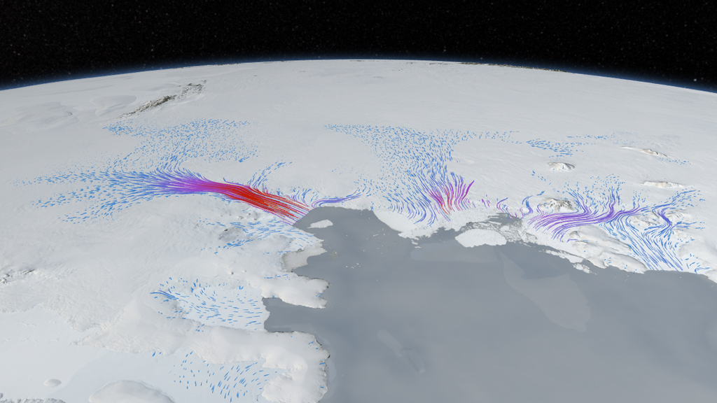
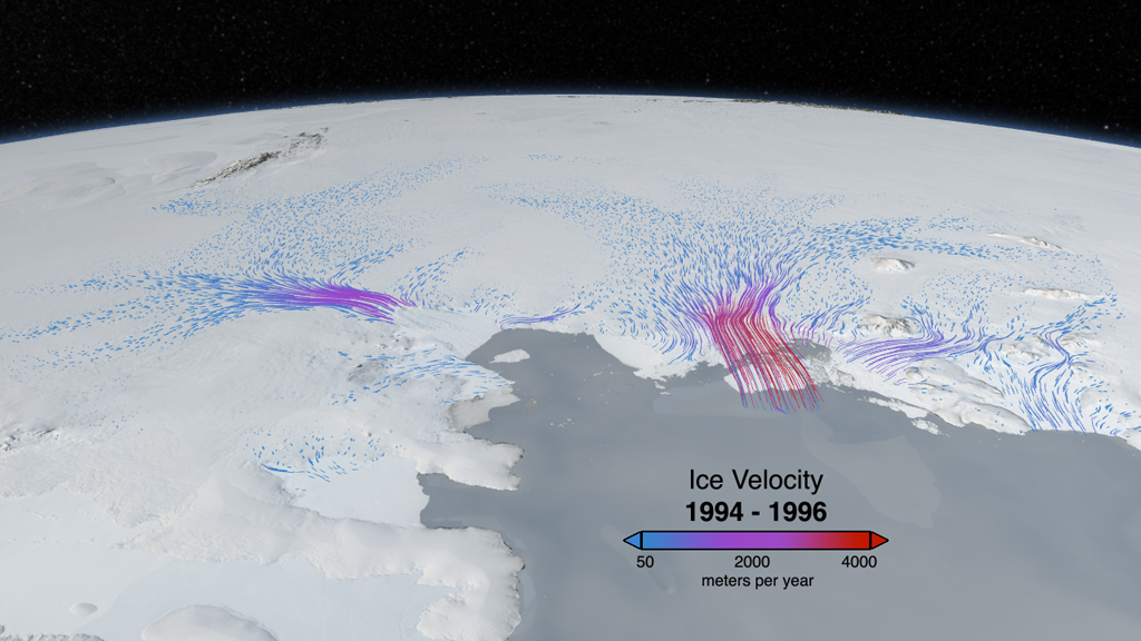
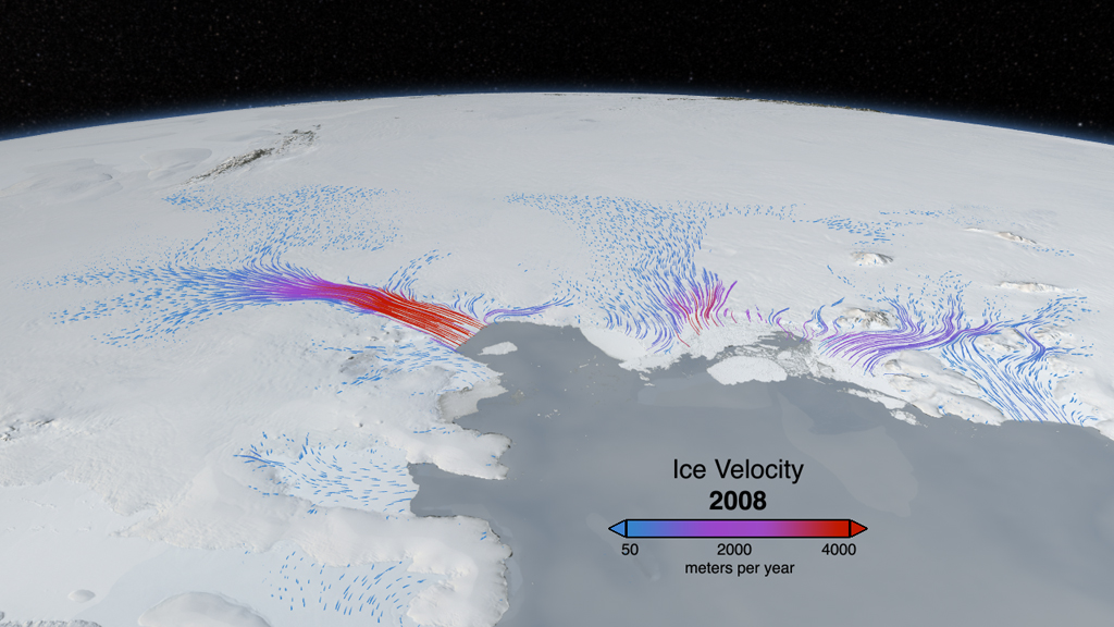
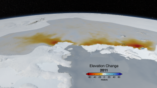
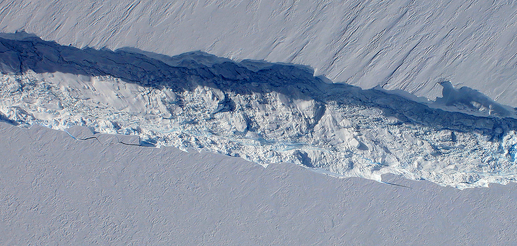
Pine Island Glacier was first called the "weak underbelly" of the West Antarctic Ice Sheet almost 30 years ago. The nickname stuck in glaciology circles because scientists still fear it is true. Pine Island, or PIG, as it's often called, drains about 10 percent of the entire West Antarctic Ice Sheet. In 2006, the glacier began losing ice mass at an even faster rate than it had before. For scientists concerned with how much PIG could contribute to sea level rise if it lives up to its moniker, there are two key questions. First, why is it changing? Scientists are investigating, among other causes, how the circulation of warming waters under the ice shelf could lead to thinning. Second, how much is it changing? Following the end of the laser altimetry mission ICESat in 2009, NASA launched an airborne campaign called Operation IceBridge to measure critical polar regions. A laser altimeter onboard NASA's DC-8 research airplane has observed PIG continuing the rapid ice loss—measured as a change in elevation—that began to accelerate in 2006. Watch in the visualization below, an analysis partly based on satellite and aircraft data, how NASA has charted PIG's increasing changes.
West Antarctica's Weak Spot
Related Story
For More Information
Story Credits
Visualizer/Animator:
Cindy Starr (Global Science and Technology, Inc.)
Producer:
Jefferson Beck (USRA)
Lead Scientist:
Benjamin E. Smith (University of Washington Applied Physics Lab Polar Science Center)
Project Support:
James W. Williams (GST)
Shiloh Heurich (GST)
Lead Writer:
Patrick Lynch (Wyle Information Systems)
Cindy Starr (Global Science and Technology, Inc.)
Producer:
Jefferson Beck (USRA)
Lead Scientist:
Benjamin E. Smith (University of Washington Applied Physics Lab Polar Science Center)
Project Support:
James W. Williams (GST)
Shiloh Heurich (GST)
Lead Writer:
Patrick Lynch (Wyle Information Systems)
Please give credit for this item to:
NASA's Goddard Space Flight Center
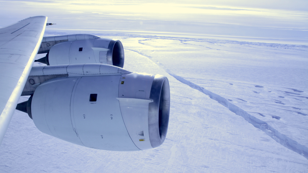
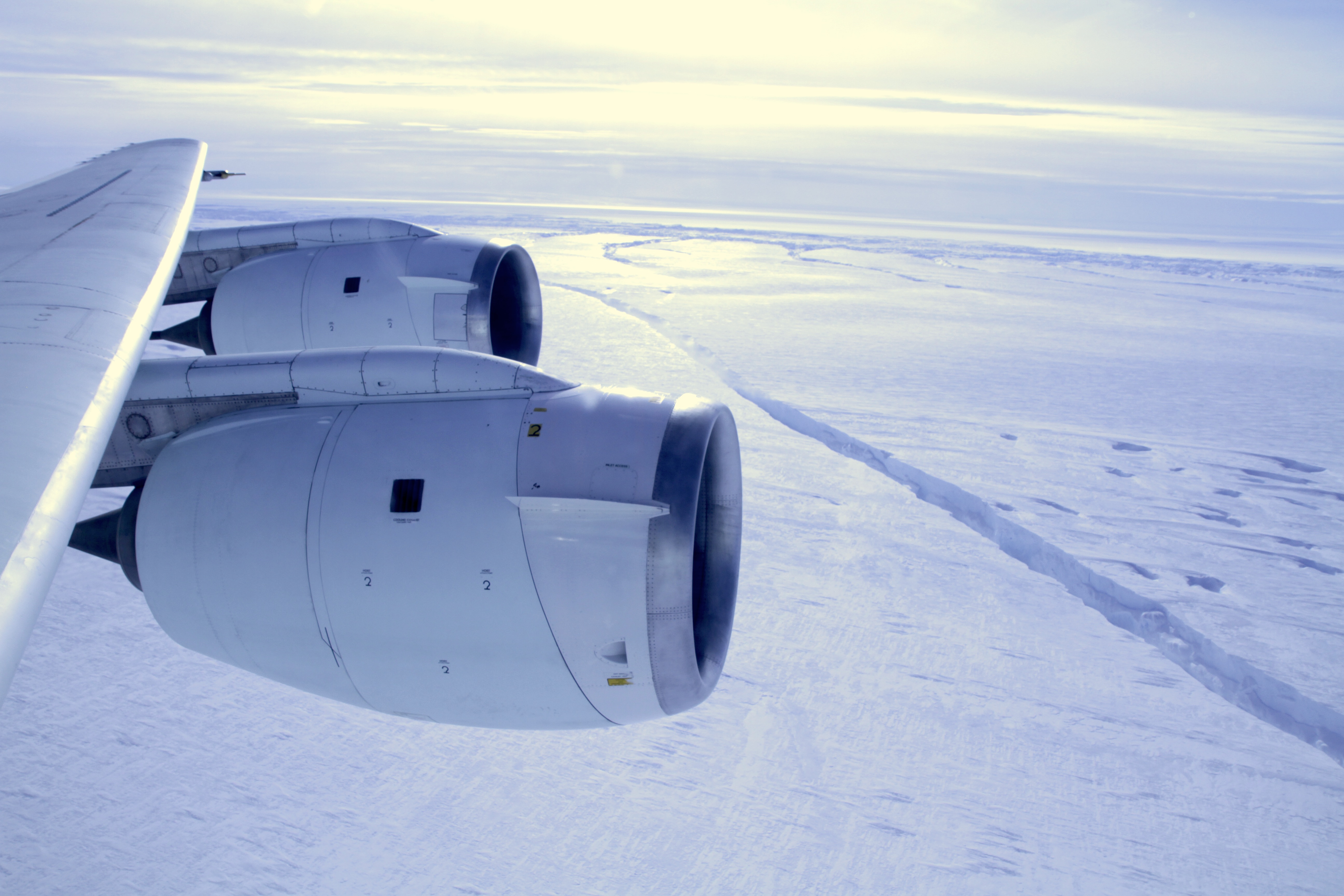
Photograph of Pine Island Glacier ice shelf crack courtesy of NASA/GSFC/Jefferson Beck
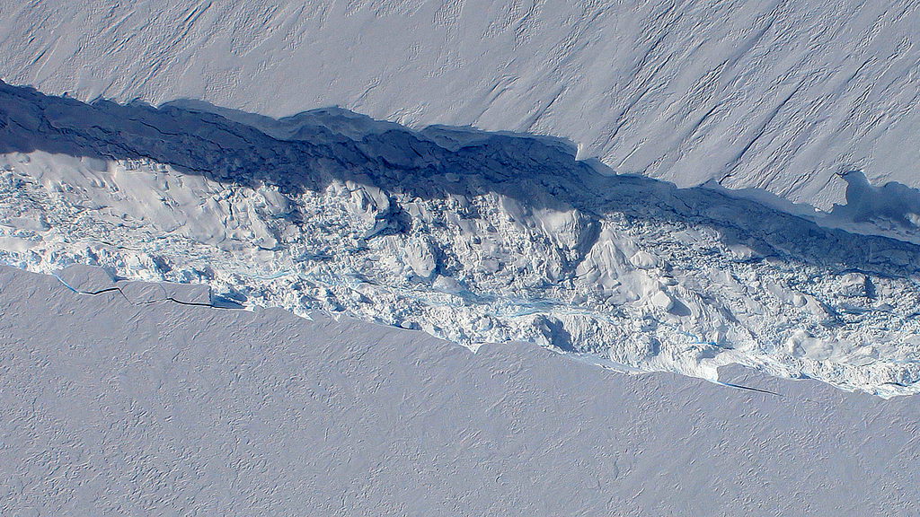
Photograph of Pine Island Glacier ice shelf crack courtesy of NASA's Digital Mapping System team
NASA's Goddard Space Flight Center
Photograph of Pine Island Glacier ice shelf crack courtesy of NASA/GSFC/Jefferson Beck
Photograph of Pine Island Glacier ice shelf crack courtesy of NASA's Digital Mapping System team
Short URL to share this page:
https://svs.gsfc.nasa.gov/10827
Keywords:
SVS >> App
NASA Science >> Earth
https://svs.gsfc.nasa.gov/10827
Keywords:
SVS >> App
NASA Science >> Earth


