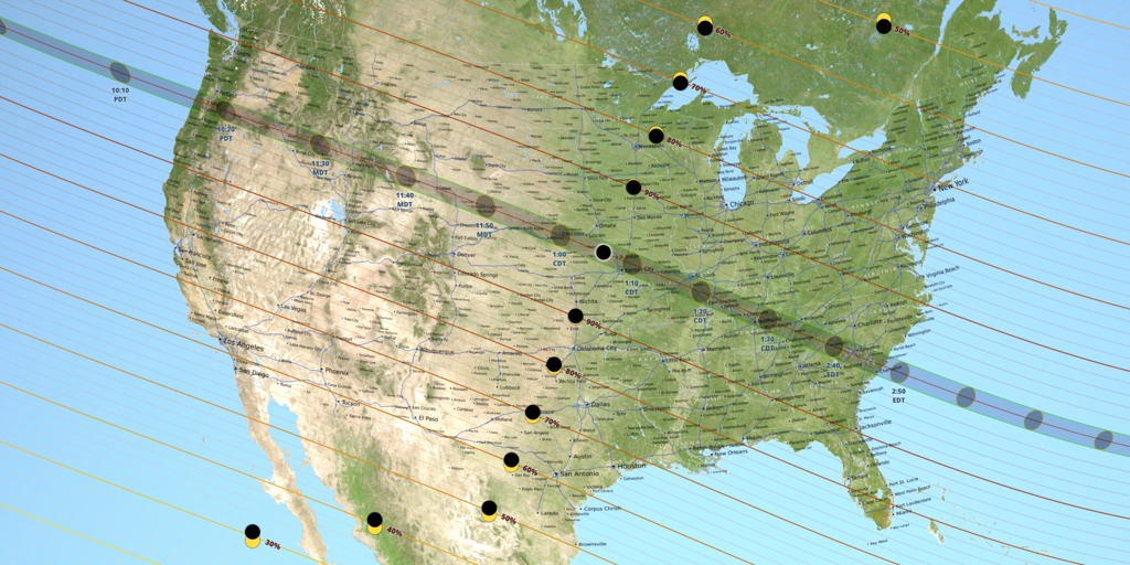
2017 Eclipse State Maps
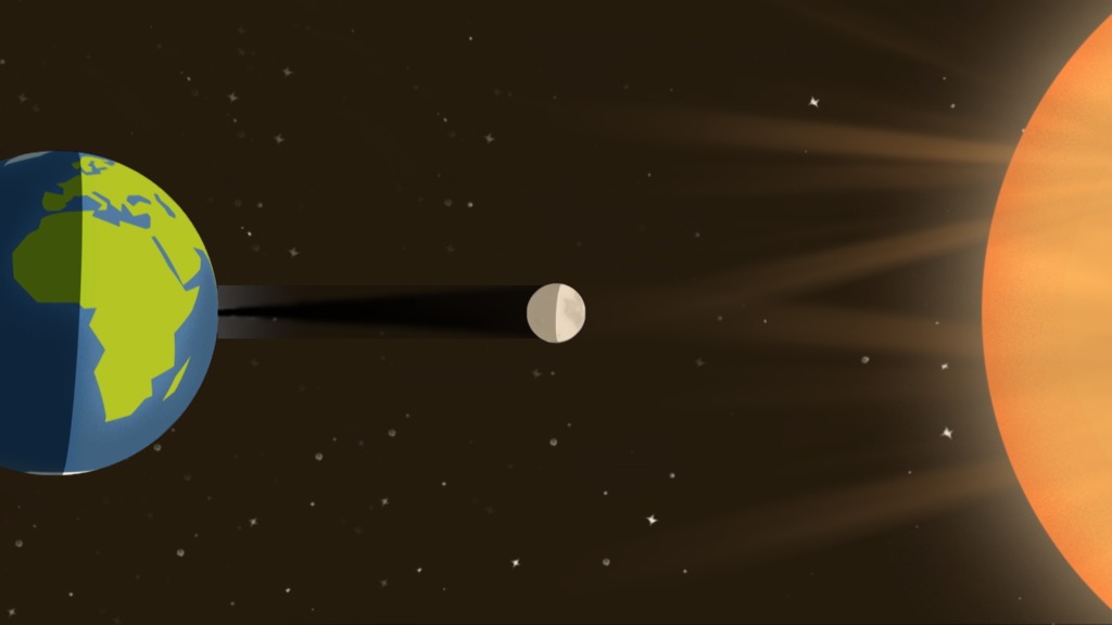
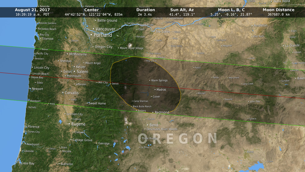
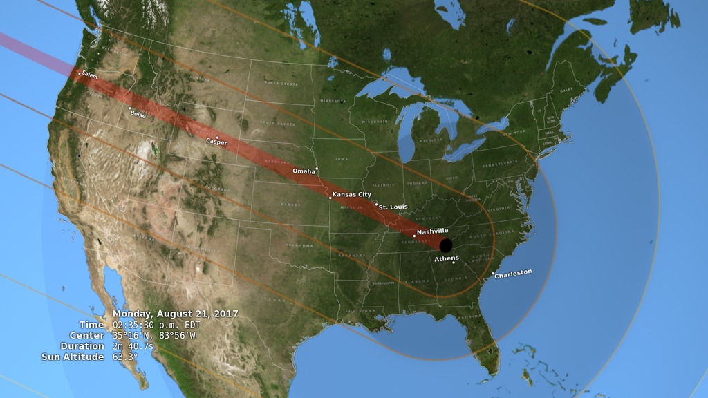
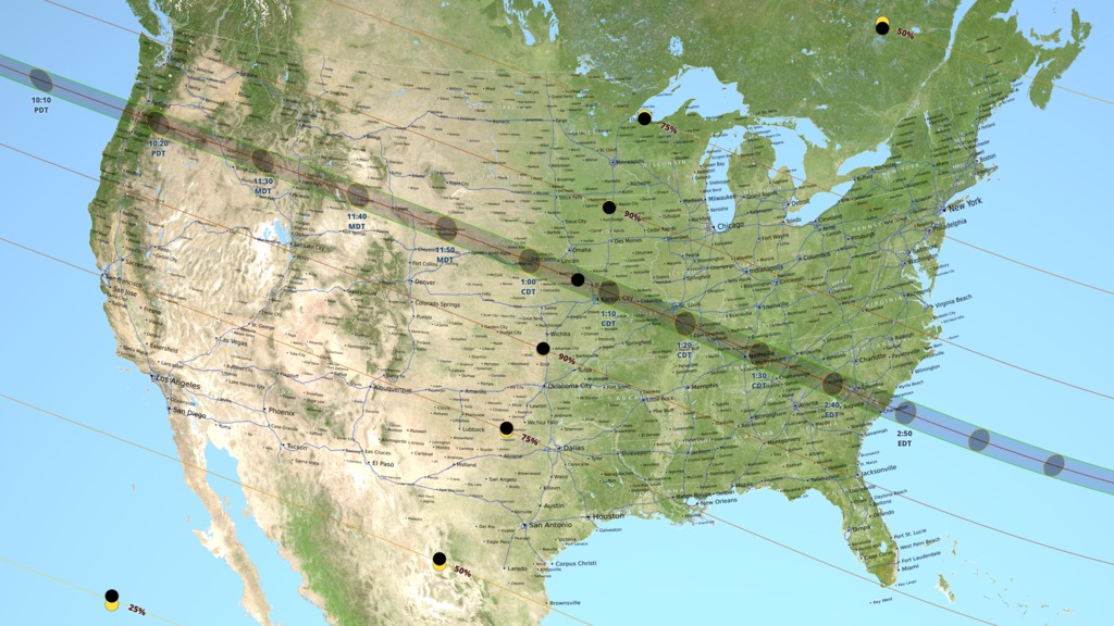
The path of totality passes through 14 states during the total solar eclipse on August 21, 2017. A map of each of these states, created for NASA's official eclipse 2017 website, is presented here. Except for Montana, each map is 8 inches wide (or high) at 300 DPI. The umbra is shown at 3-minute intervals, with times in the local time zone at the umbra center. The duration of totality is outlined in 30-second increments. Interstate highways are blue, other major roads are red, and secondary roads are gray.
Some sources list only 12 states for this eclipse, but in fact the path of totality also grazes the southwestern borders of both Montana and Iowa. The Montana part of the path is in a roadless area at the southern end of the Beaverhead Mountains, a range that defines sections of both the Montana-Idaho border and the Continental Divide. The Iowa part of the path is west of Interstate 29 near Hamburg, south of 310 Street, and bounded on the west by the Missouri River. It includes the Lower Hamburg Bend Wildlife Management Area.

Oregon
Montana
Idaho
Wyoming
Nebraska
Iowa
Kansas
Missouri
Illinois
Kentucky
Tennessee
Georgia
North Carolina
South Carolina
For More Information
Credits
Please give credit for this item to:
NASA's Scientific Visualization Studio
-
Visualizer
- Ernie Wright (USRA)
-
Scientist
- C. Alex Young (NASA/GSFC)
Release date
This page was originally published on Monday, February 6, 2017.
This page was last updated on Thursday, January 25, 2024 at 12:08 AM EST.
Series
This visualization can be found in the following series:Datasets used in this visualization
-
DEM [SRTM: SIR-C]
ID: 481 -
BMNG (Blue Marble: Next Generation) [Terra and Aqua: MODIS]
ID: 508Credit: The Blue Marble data is courtesy of Reto Stockli (NASA/GSFC).
This dataset can be found at: http://earthobservatory.nasa.gov/Newsroom/BlueMarble/
See all pages that use this dataset -
DEM (Digital Elevation Map) [LRO: LOLA]
ID: 653 -
DE421 (JPL DE421)
ID: 752Planetary ephemerides
This dataset can be found at: http://ssd.jpl.nasa.gov/?ephemerides#planets
See all pages that use this dataset -
SLDEM2015 (DIgital Elevation Model) [LRO/SELENE: LOLA/TC]
ID: 948A digital elevation model of the Moon derived from the Lunar Orbiter Laser Altimeter and the SELENE Terrain Camera. See the description in Icarus. The data is here.
See all pages that use this dataset -
North America Roads (Natural Earth: North America Roads)
ID: 968The 1:1,000,000 scale roads database for North America from Natural Earth: http://www.naturalearthdata.com/downloads/10m-cultural-vectors/roads/. This data is in the public domain. Terms of use: http://www.naturalearthdata.com/about/terms-of-use/.
See all pages that use this dataset -
2010 Census Gazetteer
ID: 969This dataset can be found at: https://www.census.gov/geo/maps-data/data/gazetteer2010.html
See all pages that use this dataset
Note: While we identify the data sets used in these visualizations, we do not store any further details, nor the data sets themselves on our site.
Related
- ID: 12648
 Produced Video
 - ID: 12625

- ID: 12535
 Produced Video
 - ID: 4515
 Visualization
 - ID: 4518
 Visualization
 - ID: 4314
 Visualization
Used as a Source In
- ID: 12458
 Produced Video