ICESat-2 Measurements Over Antarctica (prelaunch)
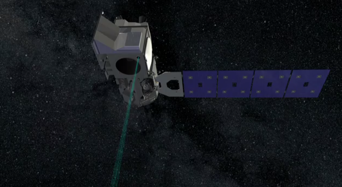
ICESat-2 has 3 pairs of lasers that will measure the heights of ice and snow at very high resolution
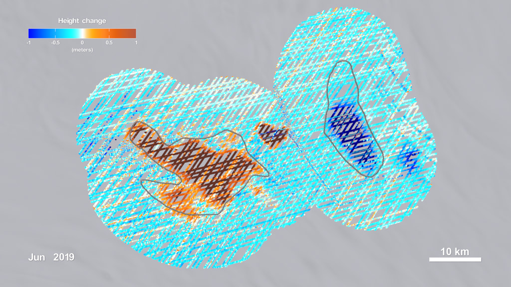
The ATLAS lidar on ICESat-2 uses 6 laser beams to measure the earth’s elevation and elevation change. As a global mission, ICESat-2 will collect data over the entire globe, however the ATLAS instrument is optimized to measure land ice and sea ice elevation in the polar regions. ICESat-2 reports elevations with respect to a reference surface, called an ellipsoid. In this measurement system, shared by GPS devices, an elevation of zero meters indicates the notional sea level, although tides, wind, and waves can make the actual sea level either greater than or less than zero. The Antarctic ice sheet, shown here, ranges up to 4000m above sea level. Over the course of 91 days, ATLAS will generate 1387 ground tracks across Antarctica for each of it’s 6 beams.
Credits
Please give credit for this item to:
NASA's Scientific Visualization Studio
-
Visualizer
- Greg Shirah (NASA/GSFC)
-
Producer
- Ryan Fitzgibbons (USRA)
-
Scientist
- Thorsten Markus (NASA/GSFC)
Release date
This page was originally published on Wednesday, November 9, 2016.
This page was last updated on Tuesday, November 14, 2023 at 12:08 AM EST.
Series
This visualization can be found in the following series:Datasets used in this visualization
-
KML Icesat2 Satellite Paths
ID: 949Test satellite paths over Antarctica in KML form.
See all pages that use this dataset
Note: While we identify the data sets used in these visualizations, we do not store any further details, nor the data sets themselves on our site.
Related
- ID: 4913
 Visualization
 - ID: 13045
 Produced Video
Used as a Source In
- ID: 14261
 Produced Video
 - ID: 12977
 Produced Video
 - ID: 13062
 Produced Video
 - ID: 12768
 Produced Video