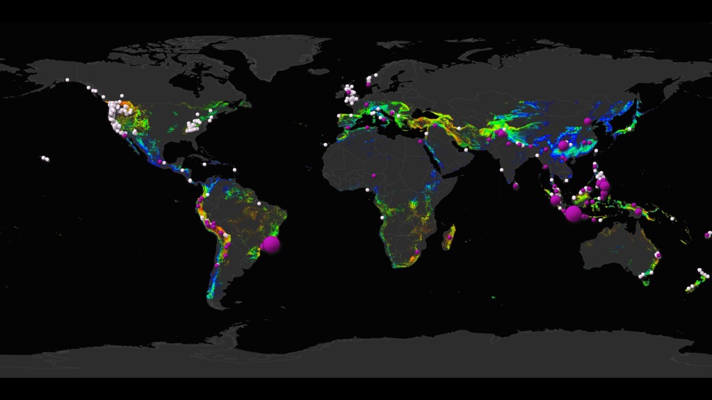
Global Rainfall-Triggered Landslides and Global Precipitation from IMERG
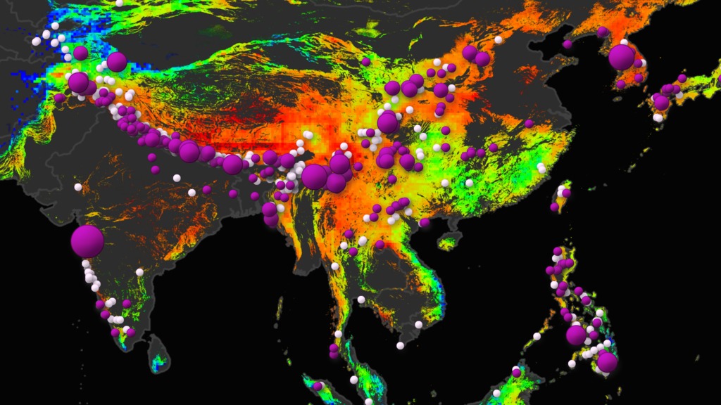
This visualization shows rainfall-triggered landslides and precipitation from August and September of 2014 in Asia and the Himalayan Arc.
Landslides occur when an environmental trigger like an extreme rain event, often a severe storm or hurricane, and gravity's downward pull sets soil and rock in motion. Conditions beneath the surface are often unstable already, so the heavy rains act as the last straw that causes mud, rocks, or debris—or all combined—to move rapidly down mountains and hillsides. Unfortunately, people and property are often swept up in these unexpected mass movements. Landslides can also be caused by earthquakes, surface freezing and thawing, ice melt, the collapse of groundwater reservoirs, volcanic eruptions, and erosion at the base of a slope from th flow of river or ocean water. But torrential rains most commonly activate landslides. The NASA Global Landslide Catalog (GLC) was developed with the goal of identifying rainfall-triggered landslide events around the world, regardless of size, impact, or location. The GLC considers all types of mass movements triggered by rainfall, which have been reported in the media, disaster databases, scientific reports, or other sources. THe GLC has been compiled since 2007 at NASA Goddard Space Flight Center. Here the GLC is shown with precipitation data detected by NASA's Integrated Multi-satellite Retrieval for the Global Precipitation Measurement Mission (GPM) (IMERG).
Landslide inventories are critical to support investigations of where and when landslides have happened and may occur in the future; however, there is surprisingly little information on the historical occurrence of landslides at the global scale. This visualization displays all rainfall-triggered landslides from 2007 through March 2015 from a publically available global rainfall-triggered landslide catalog (GLC). This is a valuable database for characterizing global patterns of landslide occurence and evaluating relationshipswith extreme precipitation at regional and global scales. For more information on the Global Landslide Catalog, please visit: ojo-streamer.herokuapp.com
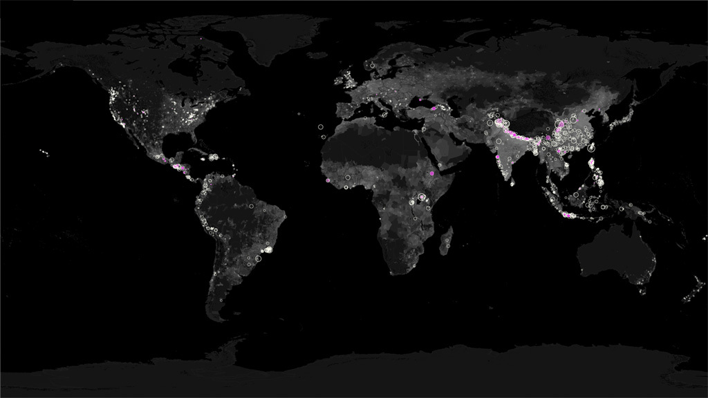
This visualization shows global rainfall-triggerd landslides and precipitation from August and September of 2014.
This is the same global image sequence as above without the colorbars added.

New rainfall-triggered landslides are displayed in opaque pink. The pink overlay is varied with time so that after 7 days the pink has been completed faded away.
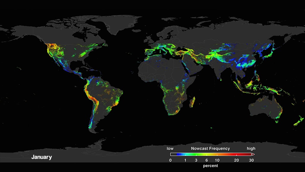
This is the rain colortable for NASA's Integrated Multi-satellite Retrieval for GPM(IMERG) product. GPM is NASA's Global Precipitation Mission.
This is the colortable for the Global Population in 2000. NASA's Socioeconomic Data and Applications Center (SEDAC) provides the Gridded Population of the World (GPW), version 3 for 2000.
This is the snow colortable for NASA's Integrated Multi-satellite Retrieval for GPM(IMERG) product. GPM is NASA's Global Precipitation Mission.
Global Landslide Catalog fatalities legend
Background Earth population image with topography
Credits
Please give credit for this item to:
NASA's Scientific Visualization Studio
-
Scientists
- Dalia B Kirschbaum (NASA/GSFC)
- George Huffman (NASA/GSFC)
-
Data visualizers
- Lori Perkins (NASA/GSFC)
- Horace Mitchell (NASA/GSFC)
-
Data provider
- Thomas A. Stanley (USRA)
Release date
This page was originally published on Wednesday, July 1, 2015.
This page was last updated on Tuesday, November 14, 2023 at 12:06 AM EST.
Missions
This visualization is related to the following missions:Series
This visualization can be found in the following series:Datasets used in this visualization
-
IMERG
ID: 863This dataset can be found at: http://pmm.nasa.gov/sites/default/files/document_files/IMERG_ATBD_V4.4.pdf
See all pages that use this dataset -
GLC (Global Landslide Catalogue)
ID: 872
Note: While we identify the data sets used in these visualizations, we do not store any further details, nor the data sets themselves on our site.
Related
- ID: 4631
- ID: 4640
- ID: 12897
- ID: 4633
- ID: 11926
 Produced Video