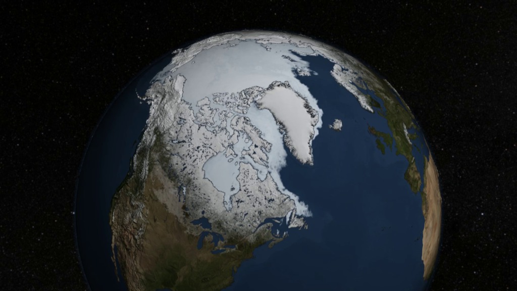
Average September Arctic Sea Ice Comparison: 1979 vs 2013
This visualization compares the difference in the area, volume and depth of the average September Arctic sea ice between 1979, shown in blue, and 2013, shown in orange. The data from these two years has been projected onto a circle to provide for easy visual comparison without altering its area or volume. The depth is shown as a histogram that is uniform rotationally around the central axis. Each grid cell of the ground plane is 1,000 kilometers in width, or one million square kilometers per cell. The depth of the sea ice is measured in meters.
This data comes from the Pan-Arctic Ice Ocean Modeling and Assimilation System (PIOMAS). This system combines real observations of the Arctic sea ice from 1979 through the present with data of the ocean and atmosphere to produce a complete picture of the changes in Arctic Sea ice area, thickness, and volume. The sharp spike at the center of the visualization represents the very real phenomenon of thick ice ridges formed by ice dynamics. PIOMAS is more completely described here.
This animation shows the difference in the area, volume and depth of the average September Arctic sea ice between 1979 and 2013.
This video is also available on our YouTube channel.

A high resolution image showing the difference in the area covered by the average September sea ice in 1979 (blue) vs 2013 (orange). The lower left corner of the grid shows the size of a 1,000 by 1,000 kilometer grid cell.
This high resolution image shows the difference between the average September Arctic sea ice depth in 1979 (blue) vs. 2013 (orange). The depth of the sea ice measured in meters is shown on the central axis.
Credits
Please give credit for this item to:
NASA's Scientific Visualization Studio
-
Visualizer
- Cindy Starr (Global Science and Technology, Inc.)
-
Animators
- Horace Mitchell (NASA/GSFC)
- Helen-Nicole Kostis (USRA)
-
Producer
- Jefferson Beck (USRA)
-
Project support
- Laurence Schuler (ADNET Systems, Inc.)
- Ian Jones (ADNET Systems, Inc.)
Release date
This page was originally published on Thursday, September 18, 2014.
This page was last updated on Wednesday, May 3, 2023 at 1:50 PM EDT.
Papers used in this visualization
Schweiger, A., R. Lindsay, J. Zhang, M. Steele, H. Stern, Uncertainty in modeled arctic sea ice volume, J. Geophys. Res., doi:10.1029/2011JC007084, 2011
Zhang, J.L. and D.A. Rothrock, Modeling global sea ice with a thickness and enthalpy distribution model in generalized curvilinear coordinates, Mon. Weather Rev., 131, 845-861, 2003
Datasets used in this visualization
-
PIOMAS Monthly Average Arctic Sea Ice Volume
ID: 841
Note: While we identify the data sets used in these visualizations, we do not store any further details, nor the data sets themselves on our site.
Related
- ID: 11654
 Produced Video