NCCS Hyperwall Show: Attribution of February 2010 East Coast Snowstorms
Three major snowstorms hit the east coast of the United States in the winter of 2009-2010. Scientists then posed the following question: What was the role of climate variability during this extreme winter? Utilizing high end computing resources at the NASA/Goddard Space Flight Center, scientists employed the use of the GEOS-5 atmospheric model in an ensemble of simulations to answer this question. Two case studies were produced. One was the winter of 2009-2010 and the other was the same months during the winter of 1999-2000. 50 member ensembles of high resolution simulations were run (each 3-months long beginning on December 1st for each winter).
The resulting findings were that GEOS-5 simulations forced with observed Sea Surface Temperatures (SST) reproduce observed changes, including enhanced storminess along the United States east coast. The ensemble members showed that this is a robust response, and verified that anomalous weather events over the U.S. are, to a large extent, driven by El Niño SST. Furthermore, North Atlantic SST contributes to the coolor (snow-producing) temperatures along the U.S. east coast.
Quicktime animation simulating the hyperwall show for regular computer displays. Normally, this show would be seen across a 5x3 display system with a total resolution of 6830x2304 pixels, but here it has been scaled down to 2000x600 pixels for easier viewing.

"Attribution of February 2010 East Coast Snowstorms" title slide. Slide reads as follows:
- Winter 2009/2010: 3 major snowstorms hit the East Coast - 2 in early February
- Climate conditions
A mature El Niño in the eastern Pacific
A persistent negative North Atlantic Oscillation (NAO)
- What is the role of climate variability in this extreme winter?
- The GEOS-5 atmospheric model is used in an ensemble of simulations to answer this question. 2 case studies, winter 2009/2010 and the opposite scenerio for 1999/2000 50-member ensembles of high resolution simulations (each 3-months long beginning December 1 for each winter).
RESULTS
- The GEOS-5 simulations forced with observed SST reproduce observed changes, including enhanced storminess along East Coast.
- Ensemble members show this is a robust response.
- Anomalies over the United States are to a large extent driven by El Niño SST.
- North Atlantic SST contribute to the cooler (snow-producing) temperatures along the U.S. east coast.
Slide showing Sea Surface Temperature Anomalies and Sea Level Pressure Anomalies between the 1999-2000 La Niña event and the 2009-2010 El Niño event.
Slide showing the similarities in precipitation and surface temperatures between the model simulation and observed data.
Animation of simulation run F42 showing winds and precipitation across the globe during the 2009-2010 winter season. Precipitation is represented through shades of blue. Light blue are areas with low amounts of precipitation. Dark blue areas represent high amounts of precipitation.
Animation of simulation run F42 showing winds and precipitation across the Northwestern hemisphere during the 2009-2010 winter season. Precipitation is represented through shades of blue. Light blue are areas with low amounts of precipitation. Dark blue areas represent high amounts of precipitation.
Animation of simulation run F13 showing winds and precipitation across the Northwestern hemisphere during the 2009-2010 winter season. Precipitation is represented through shades of blue. Light blue are areas with low amounts of precipitation. Dark blue areas represent high amounts of precipitation.
Animation of simulation run F04 showing winds and precipitation across the Northwestern hemisphere during the 2009-2010 winter season. Precipitation is represented through shades of blue. Light blue are areas with low amounts of precipitation. Dark blue areas represent high amounts of precipitation.
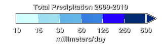
Colorbar for total precipitation during the 2009-2010 winter season.
Animation of simulation run F42 showing winds and precipitation across the globe during the 1999-2000 and 2009-2010 winter seasons. Precipitation for the 2009-2010 winter season is represented with shades of blue. Precipitation for the 1999-2000 winter season is represented with shades of orange. Light blue and light orange areas show low amounts of precipitation. Dark blue and dark orange areas represent high amounts of precipitation.
Animation of simulation run F42 showing winds and precipitation across the Northwestern hemisphere during the 1999-2000 and 2009-2010 winter seasons. Precipitation for the 2009-2010 winter season is represented with shades of blue. Precipitation for the 1999-2000 winter season is represented with shades of orange. Light blue and light orange areas show low amounts of precipitation. Dark blue and dark orange areas represent high amounts of precipitation.
Animation of simulation run F13 showing winds and precipitation across the Northwestern hemisphere during the 1999-2000 and 2009-2010 winter seasons. Precipitation for the 2009-2010 winter season is represented with shades of blue. Precipitation for the 1999-2000 winter season is represented with shades of orange. Light blue and light orange areas show low amounts of precipitation. Dark blue and dark orange areas represent high amounts of precipitation.
Animation of simulation run F04 showing winds and precipitation across the globe during the 1999-2000 and 2009-2010 winter seasons. Precipitation for the 2009-2010 winter season is represented with shades of blue. Precipitation for the 1999-2000 winter season is represented with shades of orange. Light blue and light orange areas show low amounts of precipitation. Dark blue and dark orange areas represent high amounts of precipitation.
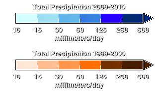
Topmost colorbar is for total precipitation during the 2009-2010 winter season. Bottom colorbar is for total precipitation during the 1999-2000 winter season.
Animation of simulation run F42 showing winds and precipitation across the globe during the 1999-2000 winter season. Precipitation for the 1999-2000 winter season is represented with shades of orange. Light orange areas show low amounts of precipitation. Dark orange areas represent high amounts of precipitation.
Animation of simulation run F42 showing winds and precipitation across the Northwestern hemisphere during the 1999-2000 winter season. Precipitation for the 1999-2000 winter season is represented with shades of orange. Light orange areas show low amounts of precipitation. Dark orange areas represent high amounts of precipitation.
Animation of simulation run F13 showing winds and precipitation across the globe during the 1999-2000 winter season. Precipitation for the 1999-2000 winter season is represented with shades of orange. Light orange areas show low amounts of precipitation. Dark orange areas represent high amounts of precipitation.
Animation of simulation run F04 showing winds and precipitation across the globe during the 1999-2000 winter season. Precipitation for the 1999-2000 winter season is represented with shades of orange. Light orange areas show low amounts of precipitation. Dark orange areas represent high amounts of precipitation.
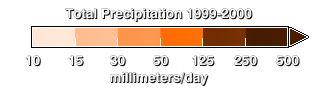
Colorbar for total precipitation during the 1999-2000 winter season.
Credits
Please give credit for this item to:
NASA/Goddard Space Flight Center Scientific Visualization Studio
-
Animators
- Alex Kekesi (Global Science and Technology, Inc.)
- Horace Mitchell (NASA/GSFC)
- Greg Shirah (NASA/GSFC)
-
Video editor
- Alex Kekesi (Global Science and Technology, Inc.)
-
Scientists
- Siegfried D. Schubert (NASA/GSFC)
- Michele Rienecker (NASA/GSFC)
- Yehui Chang (Morgan State University)
-
Project support
- Eric Sokolowsky (Global Science and Technology, Inc.)
Release date
This page was originally published on Wednesday, May 25, 2011.
This page was last updated on Tuesday, November 14, 2023 at 12:01 AM EST.
Series
This visualization can be found in the following series:Datasets used in this visualization
-
Total Precipitation (mm./day) (PRECTOT (mm./day)) [Attribution of the Extreme U.S. East Coast Snowstorm Activity of 2010]
ID: 713
Note: While we identify the data sets used in these visualizations, we do not store any further details, nor the data sets themselves on our site.