A newer version of this visualization is available.
Daily Arctic Sea Ice Minimum 2008 (using SSMI data)
Sea ice is frozen seawater floating on the surface of the ocean. Some sea ice is semi-permanent, persisting from year to year, and some is seasonal, melting and refreezing from season to season. The sea ice cover reaches its minimum extent at the end of each summer and the remaining ice is called the perennial ice cover.
This visualization shows Artic sea ice from July 1, 2008 through Septemeber 14, 2008 based on the DMSP/SSMI instrument.
The minimum Arctic sea ice extent occurred the week of September 12, 2008, when the extent was 4.52 million sq km (1.74 million sq miles).
Animation of daily Arctic sea ice 2008

Arctic sea ice on 12 September 2008
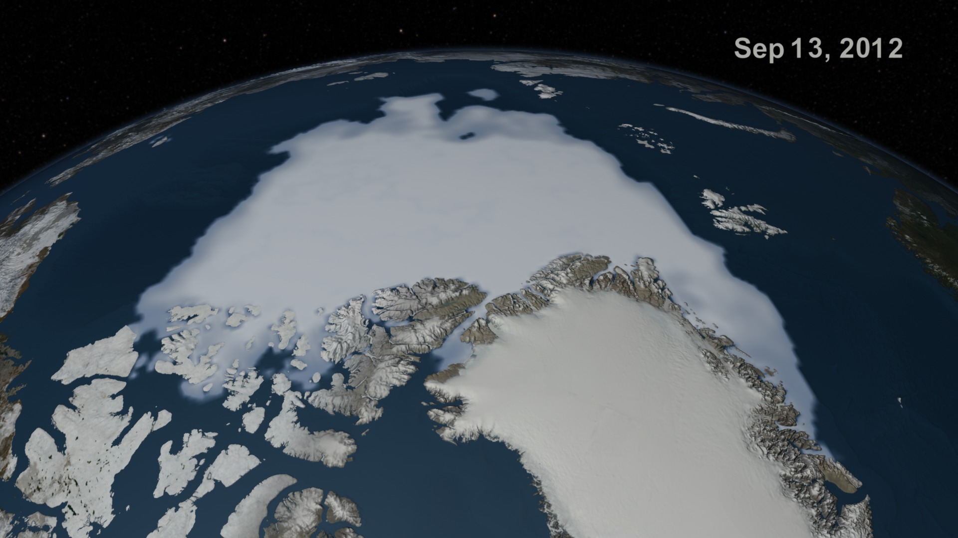
Arctic sea ice on 13 September 2008
Arctic sea ice on 14 September 2008
Credits
Please give credit for this item to:
NASA/Goddard Space Flight Center Scientific Visualization Studio. Thanks to Rob Gerston (GSFC) for providing the data.
-
Animator
- Greg Shirah (NASA/GSFC)
-
Scientist
- Josefino Comiso (NASA/GSFC)
Release date
This page was originally published on Thursday, September 11, 2008.
This page was last updated on Wednesday, May 3, 2023 at 1:55 PM EDT.
Datasets used in this visualization
-
[DMSP: SSM/I]
ID: 11Defense Meteorological Satellite Program Special Sensor Microwave Imager
See all pages that use this dataset -
Comiso's Daily Sea Ice Concentration
ID: 539
Note: While we identify the data sets used in these visualizations, we do not store any further details, nor the data sets themselves on our site.
Newer Versions
- ID: 4052