Global TRMM Rainmap 2005
This is a three-hour global rainmap from January 1, 2005 through December 31, 2005, as compiled by the TRMM satellite's Multi-satellite Precipation Analysis. The TRMM Multi-satellite Precipitation Analysis produces three hourly rain rates at 0.250 latitude by 0.250 longitude grid covering 500S to 500N. The input data for this merged product include a merged intercalibrated microwave-only product (3B40RT) and an Infrared rain product that is calibrated using microwave rain rates (3B41RT). Currently, 3B40RT is generated using rain rate estimates from microwave measurements from the TRMM sensors and the Special Sensor Microwave Imagers on board the DMSP satellites using the Goddard Profiling Algorithm (GPROF). 3B41RT is based on infrared measurements from geostationary satellites that are calibrated using microwave rain estimates. The 3B42RT estimate consists of the merged microwave estimate within the 3 hourly 0.25 degree space/time grid when available, and the calibrated IR rain rates otherwise.
This animation shows TRMM's rainfall data every 3 hours for the 2005 year. Hurricane Katrina is clearly visible in the Gulf of Mexico.

Hurricane Rita is threatening the Gulf Coast on September 25, 2005.
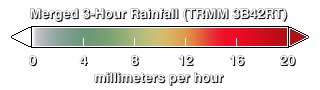
Color bar
Credits
Please give credit for this item to:
NASA/Goddard Space Flight Center
Scientific Visualization Studio
Hal Pierce (SSAI/NASA GSFC)
-
Animator
- Lori Perkins (NASA/GSFC)
-
Scientist
- Scott Braun (NASA/GSFC)
Release date
This page was originally published on Sunday, September 30, 2007.
This page was last updated on Wednesday, May 3, 2023 at 1:55 PM EDT.
Missions
This visualization is related to the following missions:Series
This visualization can be found in the following series:Datasets used in this visualization
-
3-hour Rainmap (3B4XRT) [TRMM and DMSP: SSM/I and TMI]
ID: 526This dataset can be found at: http://cics.umd.edu/~msapiano/PEHRPP/3b42rt.html
See all pages that use this dataset
Note: While we identify the data sets used in these visualizations, we do not store any further details, nor the data sets themselves on our site.