Radar Detects Oil Slick in Gulf of Mexico

An oil slick is detected in airborne radar data and satellite visible band imagery.
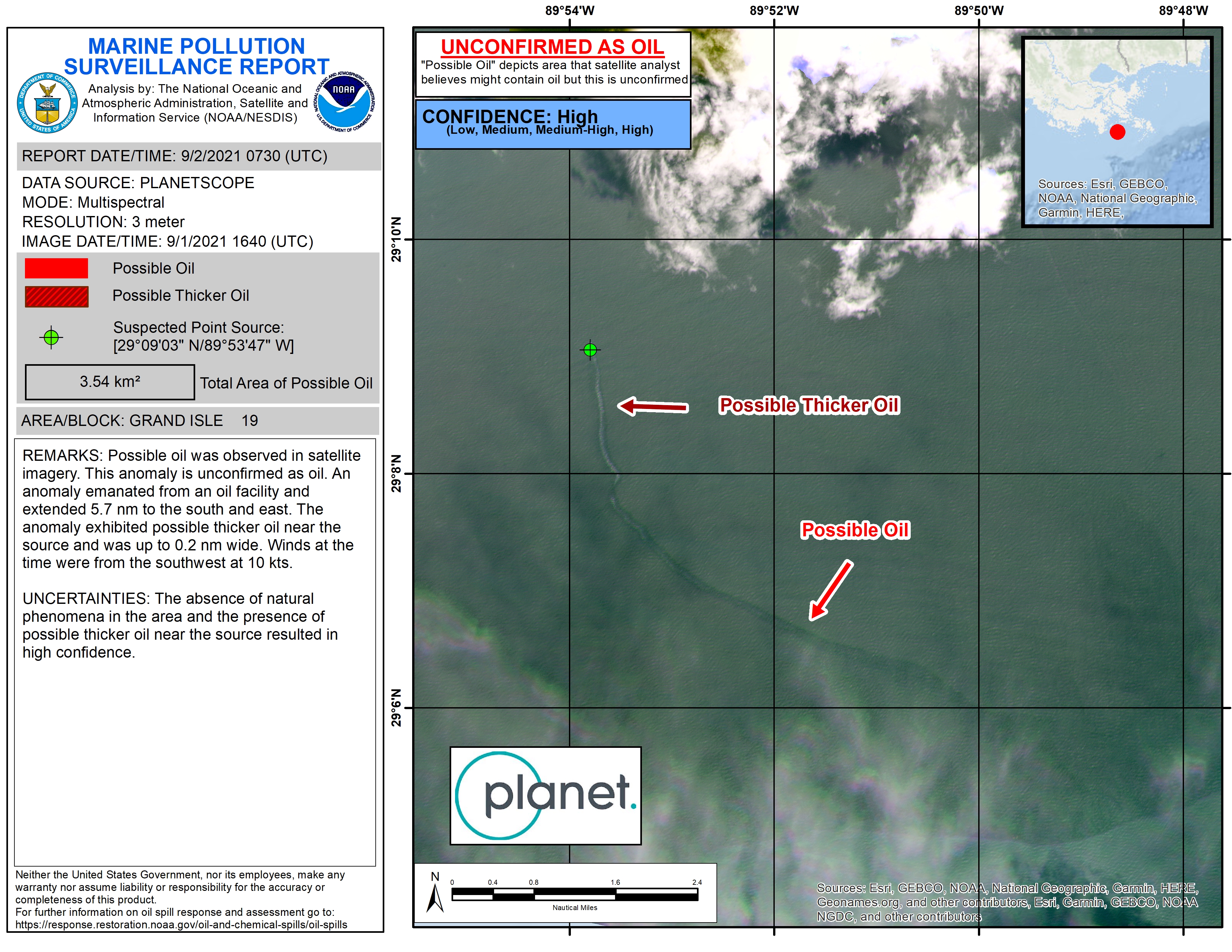
An oil slick in the Gulf of Mexico following Hurricane Ida appears as a green trail in the lower left inset false-color radar image provided by NASA's Delta-X project, while the surrounding seawater appears orange. The National Oceanic and Atmospheric Administration (NOAA) regularly monitors U.S. coastal waters for potential spills and noticed slicks that appeared just off the coast after the hurricane. They were able to use this information from Delta-X to corroborate other data they had about oil slicks in the area (Planetscope satellite image in the upper inset picture). The blue-green swath crossing from the Gulf of Mexico over the Louisiana coast denotes the flight path of the Delta-X UAVSAR radar instrument on Sept. 1, just before 11:30 a.m. CDT.
Affixed to the bottom of a Gulfstream-III airplane, the all-weather Uninhabited Aerial Vehicle Synthetic Aperture Radar (UAVSAR), bounces radar signals off of Earth's surface, forming a kind of image of a particular area. Oil tends to smooth out the bumps on the ocean's surface, which results in a distinct radar signal that the UAVSAR instrument is able to pick out of their data.
The Delta-X mission added flight paths to their planned schedule – with the support of NASA's Applied Science Disaster Program – in order to collect data over the gulf in areas of interest to NOAA.
For More Information
Credits
Please give credit for this item to:
NASA/JPL-Caltech/NOAA/Planet Labs, Inc.
-
Technical support
Release date
This page was originally published on Monday, September 27, 2021.
This page was last updated on Wednesday, November 15, 2023 at 12:44 AM EST.