Sprawling Shanghai
Shanghai sprawl over time, 1984-2022
The surge in urbanization began in the 1980s when the Chinese government began opening the country to foreign trade and investment. As markets developed in “special economic zones,” villages morphed into booming cities and cities grew into sprawling megalopolises.
Perhaps no city epitomizes the trend better than Shanghai. What had been a relatively compact industrial city of 12 million people in 1982 had swollen to 24 million in 2016, making it one of the largest metropolitan areas in the world.
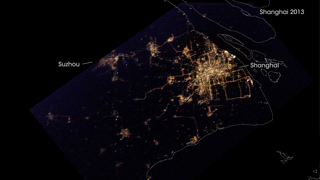
For more than four decades, Landsat satellites have collected images of Shanghai. These composite images show how cities in the Yangtze River Delta have expanded since 1984.
These “best-pixel mosaics” are made up of small parts of many images captured over five-year periods. The first image is a mosaic of scenes captured between 1984 and 1988; the second shows the best pixels captured between 2013 and 2017. This technique makes it possible to strip away clouds and haze, which are common in Shanghai.
A 2015 World Bank report noted that 7,734 square kilometers in the Yangtze River Delta Economic Zone—which includes Shanghai, Suzhou, Wuxi, and several other cities—became urban between 2000 and 2010. That is an area equivalent to 88 Manhattans. During that period, population in that zone increased by 21 million people.
For More Information
Credits
Please give credit for this item to:
NASA's Goddard Space Flight Center
-
Data visualizers
- Joshua Stevens (SSAI)
- Jesse Allen (SSAI)
-
Animator
- Amy Moran (Global Science and Technology, Inc.)
-
Writer
- Adam P. Voiland (SSAI)
Release date
This page was originally published on Friday, March 24, 2017.
This page was last updated on Tuesday, November 14, 2023 at 12:34 AM EST.
Related
- ID: 31029
 Hyperwall Visual