Southwestern Europe and Australia at Night 2014-2015
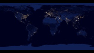
One way to study the spatial distribution, or arrangement, of human settlements is to view the planet from space during nighttime hours. Scientists have observed the Earth’s lights at night for more than four decades using military satellites and astronaut photography; however, the view became significantly clearer after using satellite data from a low-light sensor onboard the Suomi National Polar-orbiting Partnership (NPP) satellite, launched in October 2011. The satellite’s Visible Infrared Imaging Radiometer Suite (VIIRS) “day-night band” can observe dim signals such as city lights (down to the scale of an isolated highway lamp), wildfires, gas flares, auroras, and reflected moonlight during nighttime hours. Swaths of VIIRS data are processed to find moonless, non-cloudy pixels. These “good” pixels are averaged at each location to produce a global image that depicts the Earth’s lights at night. Each pixel shows roughly 0.46 miles (742 meters) across.
The top image, centered on France, is a composite of VIIRS data acquired between October 1, 2014 and April 30, 2015. Paris is visible just above the center of the image. North of Paris and across the English Channel (black), London is visible. The relatively dim Alps, characterized by their crescent-shaped geography, are speckled with lights from car headlights and lit roadways. South of the Alps several major cities in Italy are visible with the brightest spot being Milan. Rome is visible in the bottom right of the image. Strings and clusters of light out at sea are produced by ship lights.
The second image, centered on France, is a composite of data from the Defense Meteorological Satellite Program (DMSP) Operational Linescan System (OLS) acquired during 2013. Each pixel shows roughly 1.86 miles (3 kilometers) across. The DMSP OLS night-lights data are available starting in 1992, and provide the ability to measure changes in light extent and locations over the past two decades.
The image of Australia at night is a composite of VIIRS data acquired between January 1, 2015 and July 31, 2015. Major cities such as Brisbane, Sydney, Melbourne, and Perth are well lit along the coast. Alice Springs—situated in the geographic center of Australia—is some 1,500 kilometers from the nearest major city. Transient lights—those visible in only one monthly image—are colored red. These lights are mainly from brushfires burning during the dry season (May-July) in Australia’s Northern Territory and northern parts of Western Australia. Aside from fires, some of the transient lights could be attributed to natural gas flares, lightning, oil drilling, or mining operations.

A night lights image centered on France
A France night lights image from OLS has less dynamic range than VIIRS
Night lights averages over Aug 1, 2014 - Jul 31, 2015. Transient lights (those occuring in only one month) are red.
For More Information
Credits
Please give credit for this item to:
Visualization by NASA's Goddard Space Flight Center based on data from the Earth Observation Group, NOAA National Geophysical Data Center.
-
Visualizer
Release date
This page was originally published on Tuesday, October 20, 2015.
This page was last updated on Tuesday, November 14, 2023 at 12:29 AM EST.
Missions
This visualization is related to the following missions:Related
- ID: 30028
 Hyperwall Visual