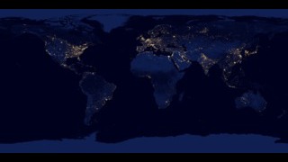
Japan at Night
Data acquired by the Visible Infrared Imaging Radiometer Suite (VIIRS) on the Suomi National Polar-orbiting Partnership (NPP) satellite were used to create this nighttime view of Japan and the Korean Peninsula in May 2014. NOAA’s Earth Observation Group creates monthly composite nighttime images from the VIIRS day-night band (DNB) by combining cloud-free data from nights without moonlight (i.e., during the new moon phase). Here the monthly composite image has been combined with a cloud-free MODIS image that has been modified to appear more “night-like” to highlight the Earth’s land surface.
City lights make several urban centers easily discernable. For example, Tokyo, Japan, located on the southeastern side of the main island, is the brightest location on the image. It is also the most populous metropolitan area in the world. Clusters of light out at sea—particularly in and around the Korean Straight—are produced by the lights from hundreds of fishing boats engaged in night fishing. One such cluster surrounds Jeju Island, South Korea—a popular tourist destination—where fishermen shine torchlights on the water to attract squid, a traditional Jeju food. The reason the lights are so prominent around the island in this image is because the time the data were collected (i.e., May during new moon) overlaps with one of the peak fishing seasons for this region—spring, during new moon.

A nighttime view of Japan made by combining VIIRS DNB imagery with a colorized cloud-free MODIS image.
Land and water cannot be differentiated using VIIRS DNB imagery acquired on un-moonlit nights.
For More Information
Credits
Please give credit for this item to:
NASA's Goddard Space Flight Center
-
Visualizer
- Marit Jentoft-Nilsen (Global Science and Technology, Inc.)
-
Writer
- Heather Hanson (Global Science and Technology, Inc.)
Release date
This page was originally published on Monday, July 28, 2014.
This page was last updated on Tuesday, November 14, 2023 at 12:26 AM EST.
Missions
This visualization is related to the following missions:Datasets used in this visualization
-
VIIRS [Suomi NPP: VIIRS]
ID: 722
Note: While we identify the data sets used in these visualizations, we do not store any further details, nor the data sets themselves on our site.
Related
- ID: 30028
 Hyperwall Visual