Landsat 9 at Work
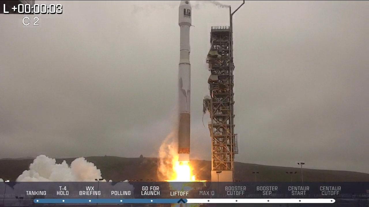
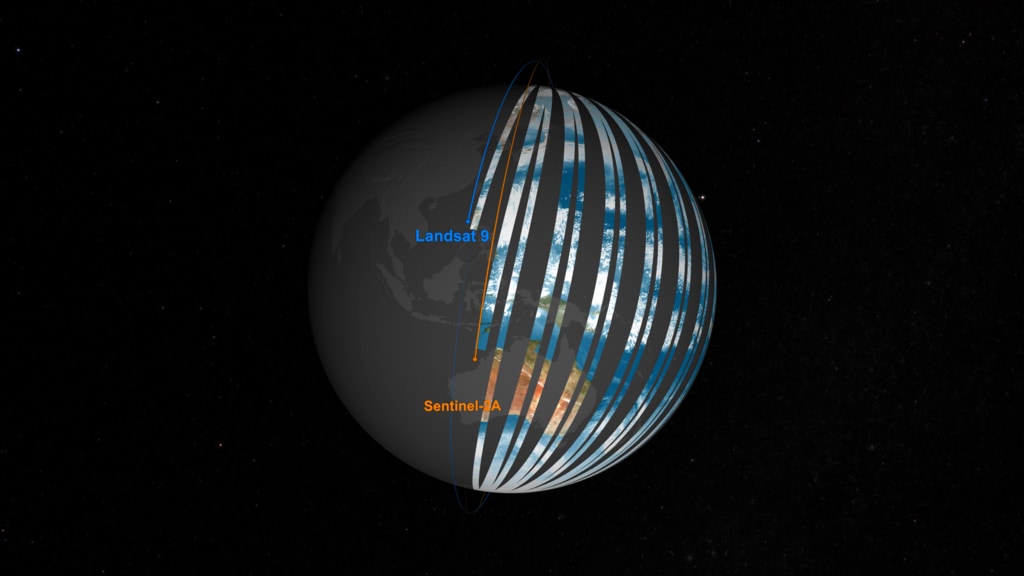
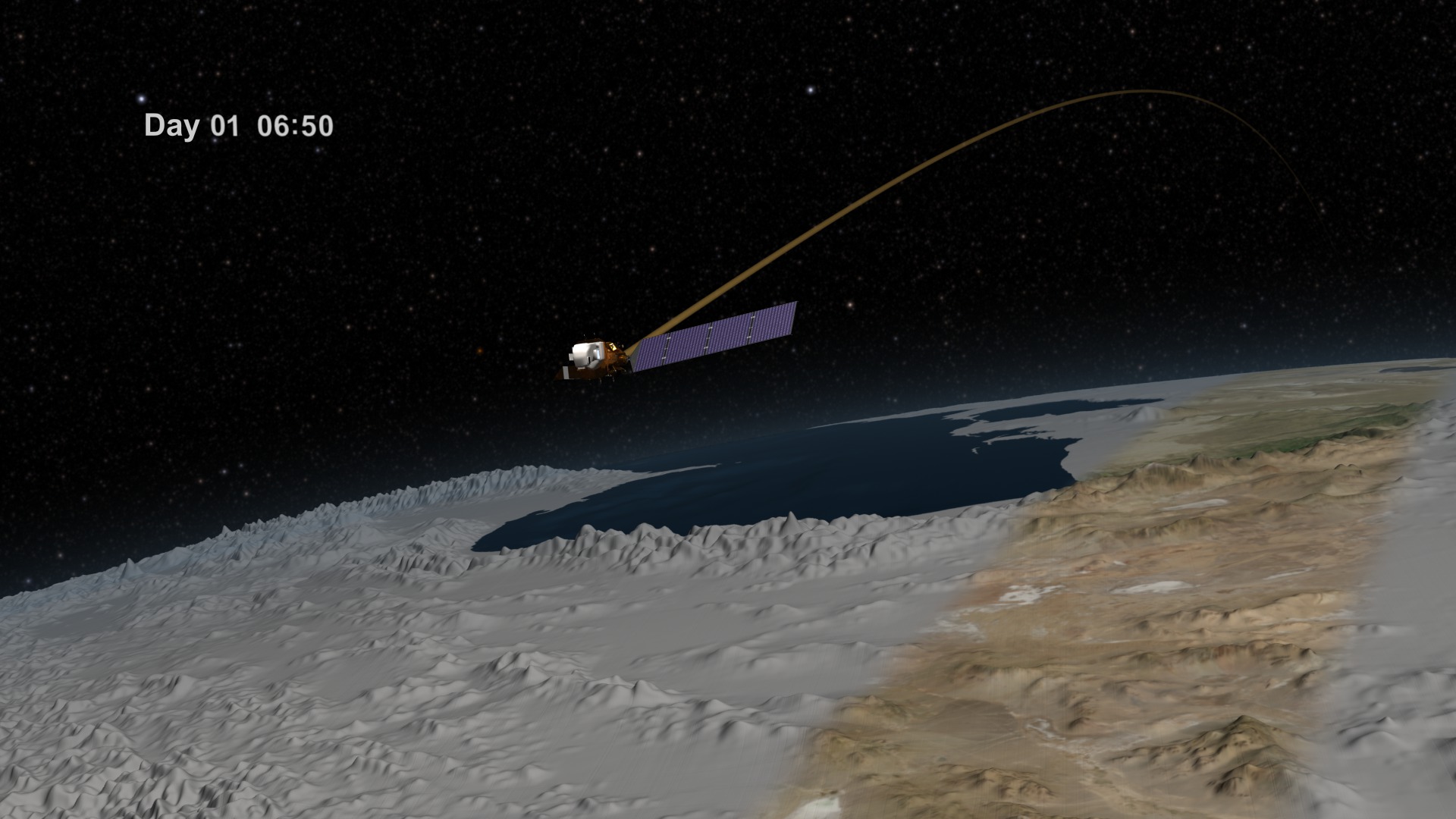
Landsat 9, launching September 2021, will collect the highest quality data ever recorded by a Landsat satellite, while still ensuring that these new measurements can be compared to those taken by previous generations of the Earth-observing satellite. Landsat 9 will enable or improve measurements of water quality, glacial ice velocity, crop water usage, and much more.
Music: The Waiting Room by Sam Dodson [PRS], Afterglow by Christopher Timothy White [PRS], both published by Atmosphere Music Ltd [PRS]; and Inner Strength by Brava/Dsilence/Input/Output [SGAE], published by El Murmullo Sarao [SGAE] and Universal Sarao [SGAE]. Available from Universal Production Music.
Complete transcript available.
Watch this video on the NASA Goddard YouTube channel.
Landsat 9, launching September 2021, will collect the highest quality data ever recorded by a Landsat satellite, while still ensuring that these new measurements can be compared to those taken by previous generations of the Earth-observing satellite.
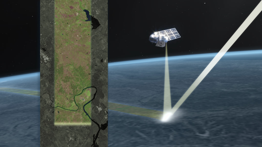
For nearly half a century, the Landsat mission has shaped our understanding of Earth. Since the launch of the first Landsat satellite in 1972, the mission has gathered and archived more than 8 million images of our home planet’s terrain, including crop fields and sprawling cities, forests and shrinking glaciers. Landsat 9 will continue and extend that long-running mission to map our home planet.
The Landsat Program is a series of Earth-observing satellite missions jointly managed by NASA and the U.S. Geological Survey (USGS). Landsat satellites have been consistently gathering data about our planet since 1972. They continue to improve and expand this unparalleled record of Earth's changing landscapes for the benefit of all.
Credits
Please give credit for this item to:
NASA's Goddard Space Flight Center
While the video in its entirety can be shared without permission, the music has been obtained through permission and may not be excised or remixed in other products.
-
Producer
- Matthew Radcliff (KBR Wyle Services, LLC)
-
Scientist
- Jeffrey Masek (NASA/GSFC)
-
Narrator
- Matthew Radcliff (KBR Wyle Services, LLC)
-
Editor
- Matthew Radcliff (KBR Wyle Services, LLC)
-
Writer
- Kate Ramsayer (Telophase)
Release date
This page was originally published on Monday, July 26, 2021.
This page was last updated on Wednesday, May 3, 2023 at 1:44 PM EDT.
Series
This visualization can be found in the following series:Related
- ID: 13946
 Produced Video
 - ID: 13920

- ID: 20322
 Animation
Sources
- ID: 4834
- ID: 4745
 Visualization
 - ID: 4528
 Visualization
 - ID: 4381
 Visualization
 - ID: 3939
 Visualization