Landsat Helps Warn of Algae in Lakes and Rivers
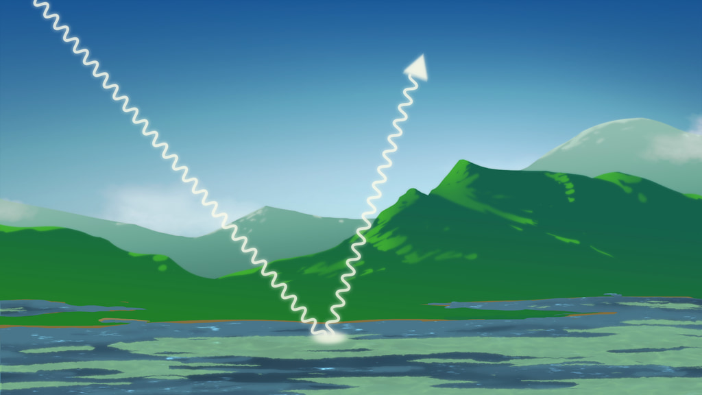
From space, satellites including the NASA and U.S. Geological Survey’s (USGS) Landsat 8 can help scientists identify lakes where an algal bloom has formed. It’s a complicated data analysis process, but one that researchers are automating so resource managers around the country can use the satellite data to identify potential problems.
Music: Light From Dark by Adam Salkedi, Neil Pollard [PRS], published by Atmosphere Music Ltd.; Experimental Design by Laurent Dury [SACEM], published by Koka Media; Against The Wall by Benjamin Peter McAvoy [PRS], published by Sound Pocket Music; Brainstorming by Laurent Dury[SACEM], published by Koka Media; Together As One by Le Fat Club [SACEM], Olivier Grim [SACEM]; published by Koka Media.
Complete transcript available.
Watch this video on the NASA Goddard YouTube channel.
From space, satellites such as the NASA and USGS Landsat 8 can help scientists identify where an algal bloom has formed in lakes or rivers. It’s a complicated data analysis process, but one that researchers are automating so resource managers around the country can use the satellite data to identify potential problems.
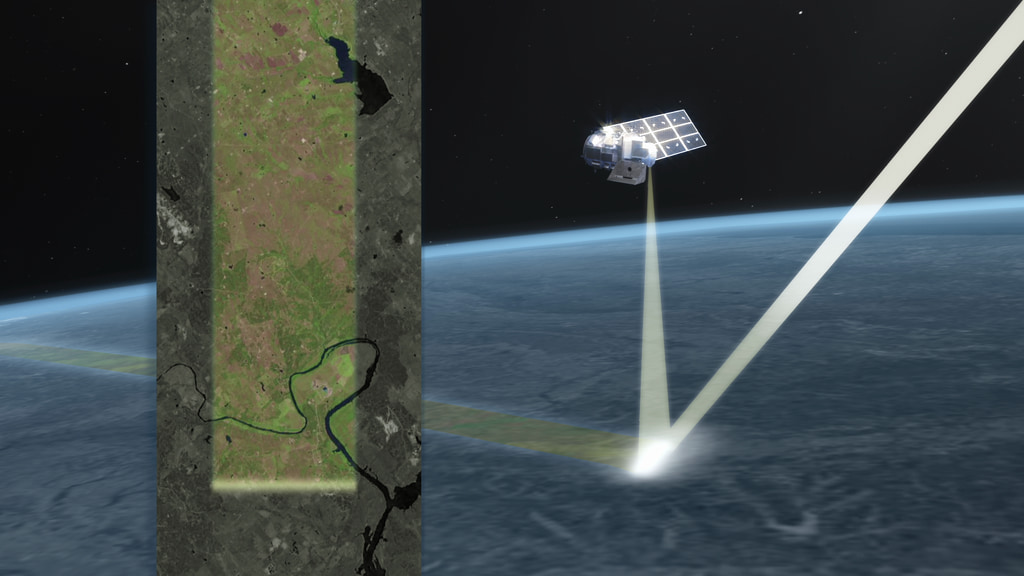
Nima Pahlevan and his team at NASA’s Goddard Space Flight Center have developed an algorithm to take the data collected by Landsat 8 over water, analyze it, and create a product for distribution. There are multiple, computationally intensive steps to get from the raw data to the usable product. This free-to-use data product makes it easier for more people to work with quality Landsat data.
The Landsat Program is a series of Earth-observing satellite missions jointly managed by NASA and the U.S. Geological Survey (USGS). Landsat satellites have been consistently gathering data about our planet since 1972. They continue to improve and expand this unparalleled record of Earth's changing landscapes for the benefit of all.
- Algae
- Algae Blooms
- Aquatic Ecosystems
- Aquatic Habitat
- Bacteria/archaea
- Biological Classification
- Biology
- Biosphere
- Cyanobacteria (blue-green Algae)
- Earth Science
- Ecological Dynamics
- Ecology
- Environmental science
- HDTV
- Hydrology
- Hydrosphere
- Landsat
- Plant Taxonomy
- Terrestrial Hydrosphere
- Toxic Blooms
- Toxicity
- Water
- Water Quality/Water Chemistry
Credits
Please give credit for this item to:
NASA's Goddard Space Flight Center.
This video can be freely shared and downloaded. While the video in its entirety can be shared without permission, some individual imagery is provided by https://www.pond5.com and is obtained through permission and may not be excised or remixed in other products. For more information on NASA’s media guidelines, visit https://www.nasa.gov/multimedia/guidelines/index.html.
Notes on footage: 0:00;00-0:05;25, 0:19;17-0:22;08, 0:35;18-0:38;10, 0:53;16-01:02;25, 02:01;14-02:06;02 was provided courtesy of www.pond5.com
-
Producer
- Matthew R. Radcliff (USRA)
-
Technical support
- Aaron E. Lepsch (ADNET Systems, Inc.)
-
Animator
- Adriana Manrique Gutierrez (USRA)
-
Writer
- Kate Ramsayer (Telophase)
-
Scientists
- Nima Pahlevan (SSAI)
- Kate Fickas (University of Utah)
-
Narrator
- Matthew R. Radcliff (USRA)
-
Editor
- Matthew R. Radcliff (USRA)
Release date
This page was originally published on Monday, March 22, 2021.
This page was last updated on Wednesday, May 3, 2023 at 1:44 PM EDT.
Series
This visualization can be found in the following series:Related
- ID: 13920
Sources
- ID: 20340
 Animation
 - ID: 20322
 Animation