NASA Supercomputing Study Breaks Ground for Tree Mapping, Carbon Research
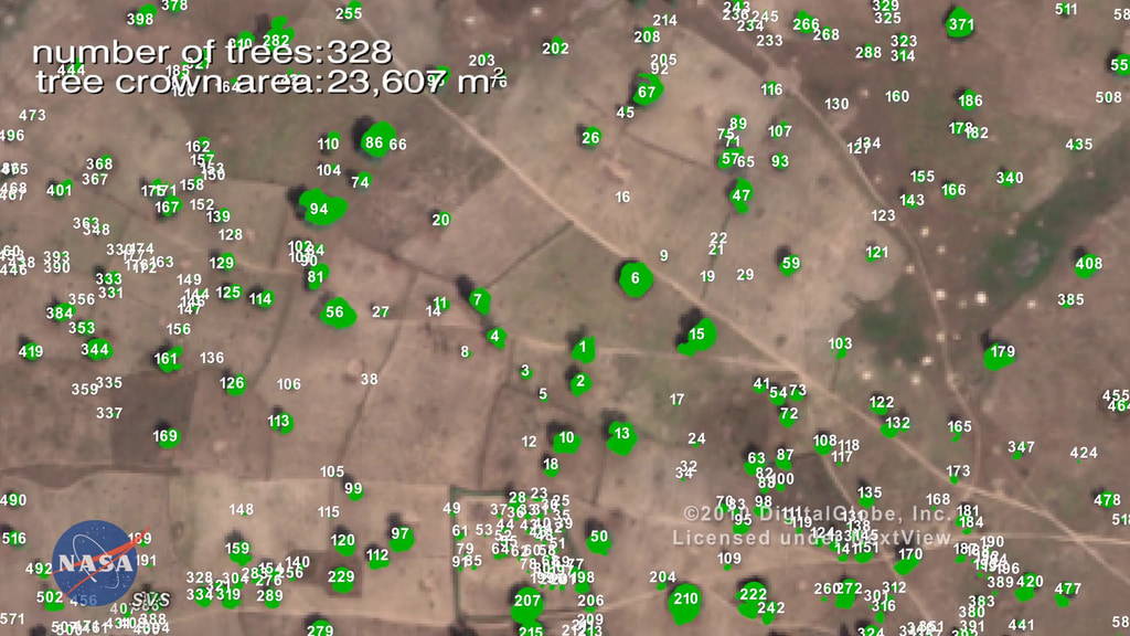
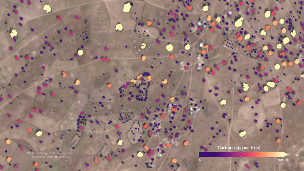
Scientists from NASA’s Goddard Space Flight Center in Greenbelt, Maryland and international collaborators demonstrated a new method for mapping the location and size of trees growing outside of forests, discovering surprisingly high numbers of trees in semi-arid regions and laying the groundwork for more accurate global measurement of carbon storage on land.
Credits
Please give credit for this item to:
NASA's Goddard Space Flight Center
-
Producer
- LK Ward (USRA)
-
Visualizer
- Greg Shirah (NASA/GSFC)
-
Writer
- Jessica Merzdorf (Telophase)
-
Scientist
- Compton Tucker (NASA/GSFC)
Release date
This page was originally published on Friday, October 16, 2020.
This page was last updated on Wednesday, May 3, 2023 at 1:44 PM EDT.
Series
This visualization can be found in the following series:Related
- ID: 5031
Sources
- ID: 4865