New NASA Campaign Tracks Wildfire Smoke for Improved Air Quality Forecasts Live Shots
B-roll for the following suggested questions:
1. We all know NASA as a space agency. How can NASA’s unique perspective inform us about wildfires?
2. NASA researchers are in the field right now tracking smoke from wildfires. What are they seeing from the air and ground?
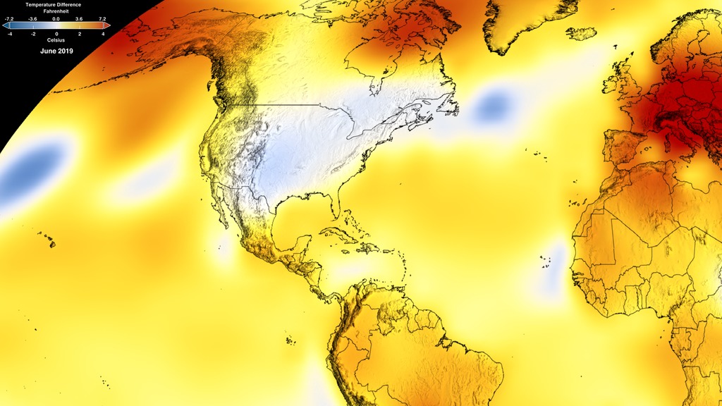
3. This June was the hottest June on record, with early data pointing to July being the warmest month on record. What impact has that had on this year’s fire season?
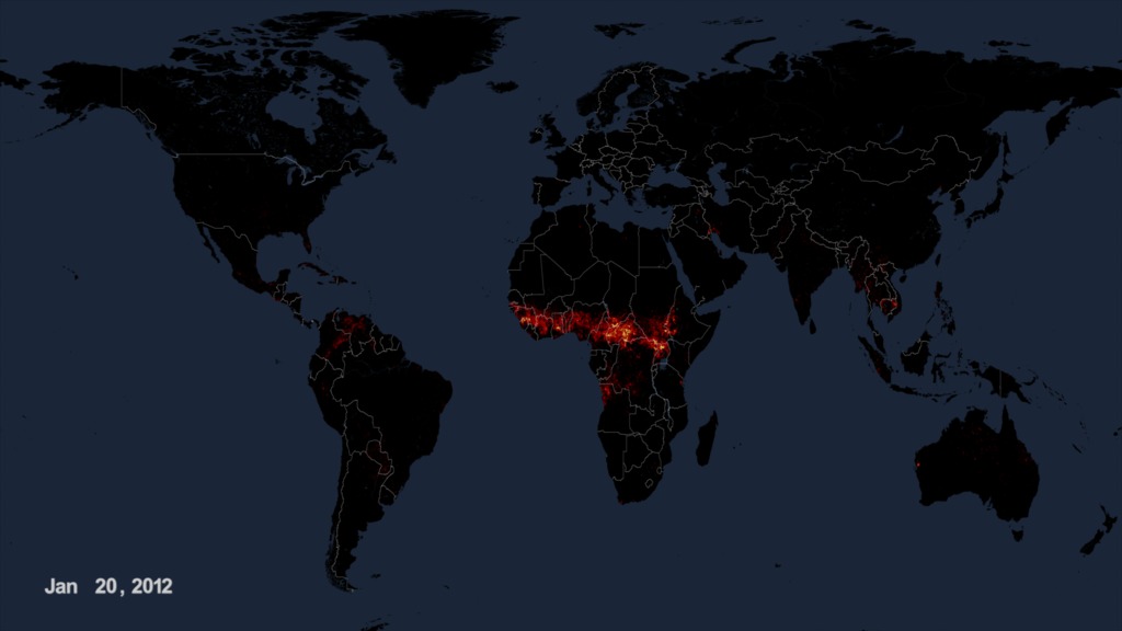
4. When you think of wildfires, you usually associate that with the western part of the U.S. How can wildfires affect us throughout the world?
5. How does a changing planet contribute to longer and hotter wildfires?
6. Where can people learn more?
Record-Breaking Heat Conditions Set the Stage for Hotter and Longer Fires Ahead
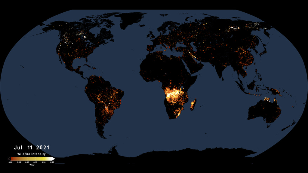
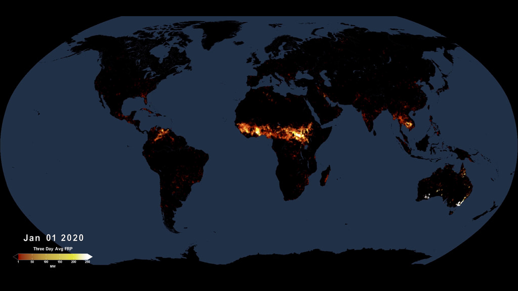
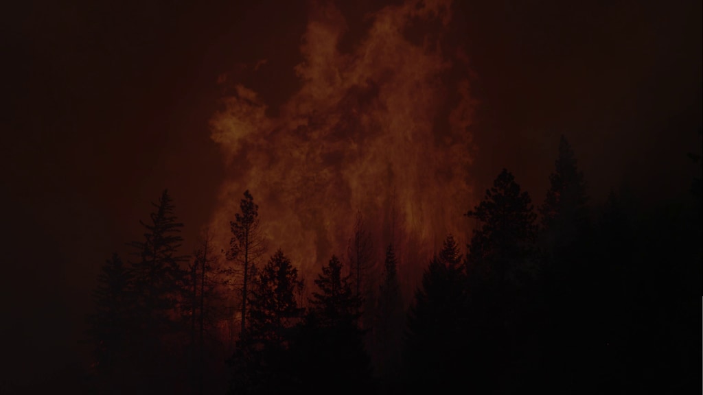
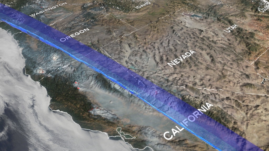
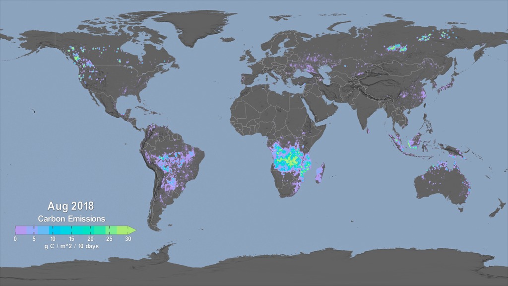
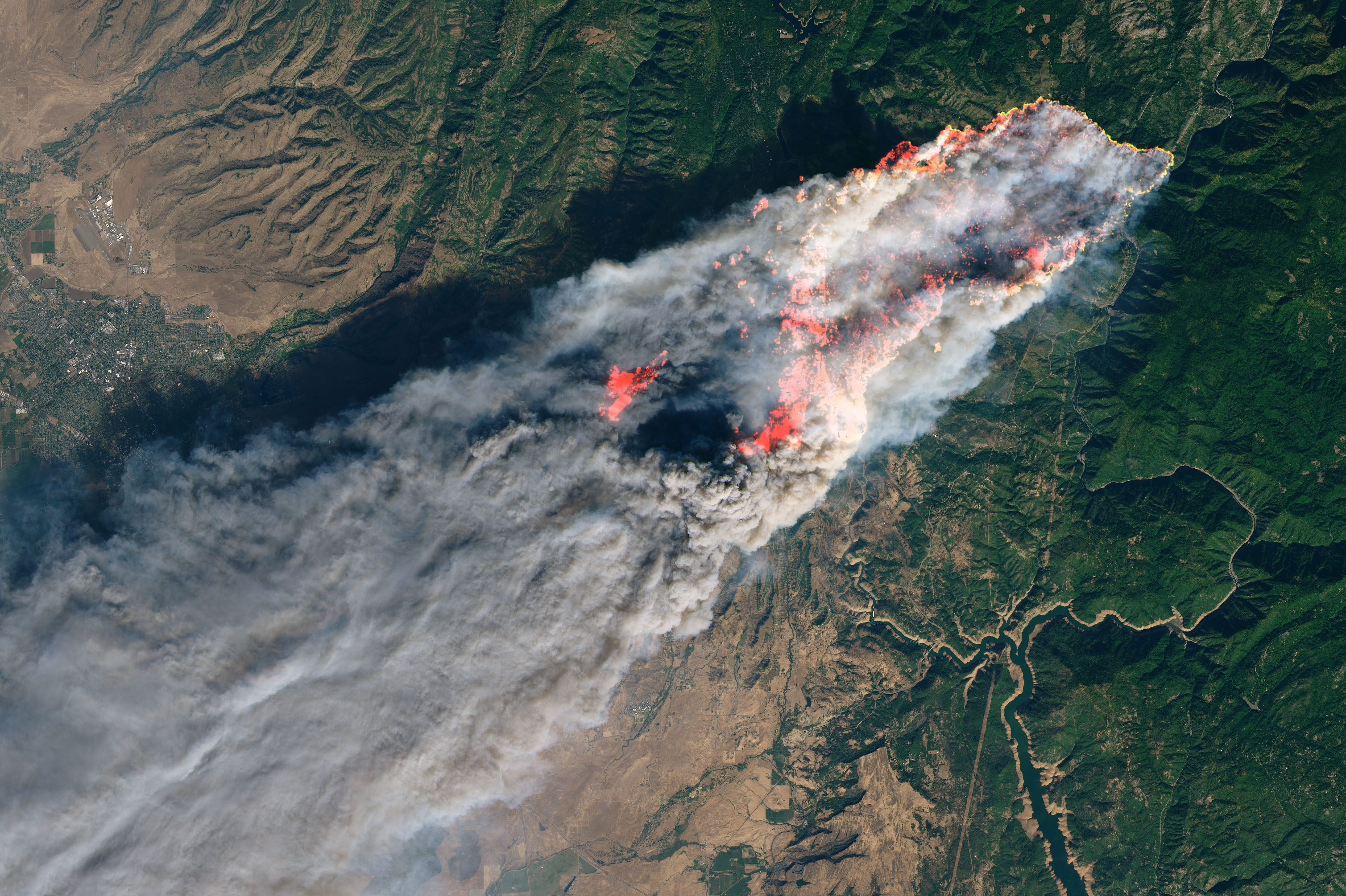
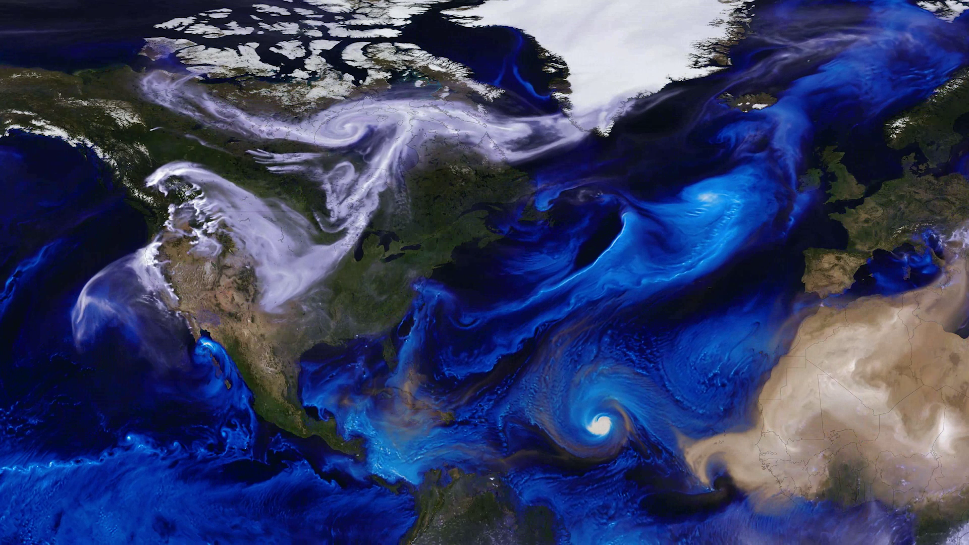
This summer, fires have raged through hundreds of thousands of acres across North America, polluting the air we breathe. The smoke from these wildfires can even cross the Atlantic Ocean and travel around the globe. This summer, NASA researchers are in the field taking on the most comprehensive campaign in the continental United States to investigate fast-traveling wildfire smoke to improve air quality forecasting. Click here for link to this feature in Spanish
This past June was the warmest June on record, and early data indicates that July of 2019 was the hottest month ever recorded. These hotter and drier conditions set the stage for more intense wildfires that can bring dangerous smoke to a city near you.
Chat with NASA scientists on Thursday, August 8 from 6:00 a.m. to 12:00 p.m. EST to find out more about what NASA is doing to track smoke and its impact on your local community.
From its unique vantage point in space, NASA serves as one of the first fire detectors. With NASA’s latest satellite technology, we can help firefighters and forest managers combat fires by tracking wildfire movement and impact in real-time.
To schedule an interview, please fill out THIS FORM.
Location for interviews is NASA’s Goddard Space Flight Center in Greenbelt, Maryland.
satellite coordinates
HD Satellite Coordinates for G17-K17/Lower: Galaxy 17 Ku-band Xp 17 Slot Lower| 91.0 ° W Longitude | DL 12031.0 MHz | Horizontal Polarity | QPSK/DVB-S | FEC ¾ | SR 13.235 Mbps | DR 18.2954 MHz | HD 720p | Format MPEG2 | Chroma Level 4:2:0 | Audio Embedded
*** Questions? Contact isabelle.c.yan@nasa.gov or 301-286-2470.
Canned interview with Dr. Doug Morton/ NASA Scientist
Click download button for audio file.
Scientist Dr. Doug Morton talks about how NASA keeps an eye on wildfires from space. TRT 1:39
Click download button for audio file.
Scientist Dr. Doug Morton talks about how NASA keeps an eye on wildfires from space. TRT :23
Click download button for audio file.
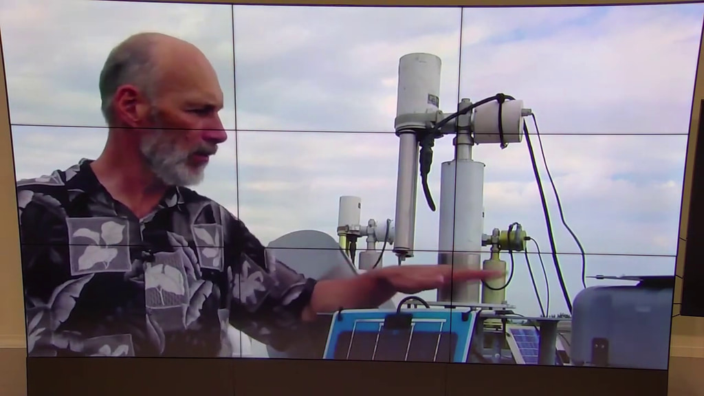
The DC-8, the largest plane participating in the FIREX-AQ campaign, is tasked with flying through smoke from wildfires to capture data on as many as 500 chemicals in a single plume. Listen as the DC-8 takes off for its 6-hour flight over a wildfire burning in Idaho.
Canned interview with NASA Scientist Dr. Elizabeth Hoy. Answers are separated by slates. TRT 3:43
Canned interview with NASA Scientist Dr. Elizabeth Hoy talking about wildfires in Alaska and how NASA is studying those wildfires with its ABoVE mission. Answers are separate by a second of black. TRT 1:56
For More Information
Credits
Please give credit for this item to:
NASA's Goddard Space Flight Center
-
Producers
- Isabelle Yan (NASA/GSFC)
- Courtney A. Lee (ADNET Systems, Inc.)
- Michelle Handleman (USRA)
- Katie Atkinson (ADNET Systems, Inc.)
- Elizabeth Tammi (GSFC Interns)
Release date
This page was originally published on Tuesday, August 6, 2019.
This page was last updated on Wednesday, May 3, 2023 at 1:45 PM EDT.
Series
This visualization can be found in the following series:Related
- ID: 4945
- ID: 4899
 Visualization
 - ID: 13281
![Music: Stepping Stone Bridge by Timothy Michael Hammond [PRS], Wayne Roberts [PRS]Watching Ladybirds by Benjamin James Parsons [PRS] This video can be freely shared and downloaded. While the video in its entirety can be shared without permission, some individual imagery provided by pond5.com and Artbeats is obtained through permission and may not be excised or remixed in other products. Specific details on stock footage may be found here. For more information on NASA’s media guidelines, visit https://www.nasa.gov/multimedia/guidelines/index.html. Complete transcript available.](/vis/a010000/a013200/a013281/Thumbnail_Arctic_Fires_Print.jpg) Produced Video
Produced Video - ID: 4746
 Visualization
 - ID: 13264
 Produced Video
 - ID: 13262
![Music: Broad Horizons by Chris White [PRS]Complete transcript available.](/vis/a010000/a013200/a013262/Still.png) Produced Video
Produced Video - ID: 4741
 Visualization
 - ID: 4729
 Visualization
 - ID: 13257
 Produced Video
 - ID: 4728
 Visualization
 - ID: 13253
 Produced Video
 - ID: 12983
 Produced Video
Used as a Source In
- ID: 31171
 Hyperwall Visual