ICESat-2's Eye on Ice

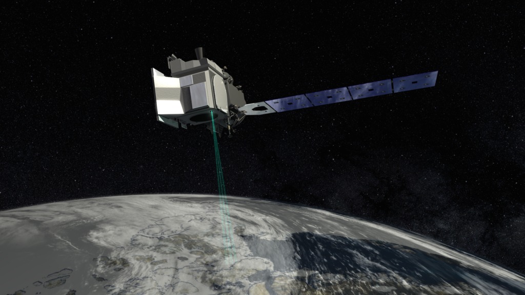
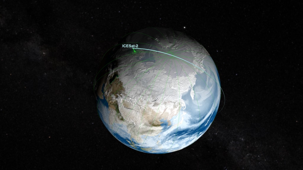
ICESat-2 measuring the height of ice from space
Ice is being lost across the globe, especially in the polar regions. The continental ice sheets of Greenland and Antarctica are shedding ice to the oceans and raising sea level. Arctic sea ice is less than half its 1980s volume. Fundamentally changing the Arctic, this ice loss may also be affecting North American and global weather. In September 2018, NASA is launching the Ice, Cloud and land Elevation Satellite-2 (ICESat-2) to measure changes in Earth’s ice and improve forecasts of the global impacts of these changes. With its fast-firing laser, the satellite will collect information enabling scientists to calculate—to within fractions of an inch—how much the vast ice sheets of Antarctica and Greenland rise or fall each year. ICESat-2 will take measurements across the globe and provide an incredibly precise height map of our planet in unprecedented detail. Its focus will be on Earth’s poles, including the Arctic region where temperatures are rising faster than at other latitudes. Watch the videos to learn more.
Learn how ICESat-2 will give scientists a global view of Earth's surface heights.
Scientists venture to the South Pole to take ground-truth measurements in preparation for ICESat-2's launch.
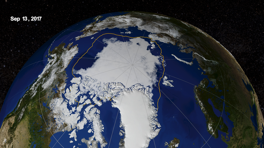
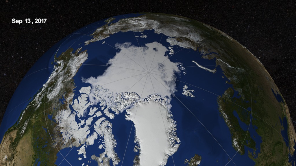
Arctic sea ice is disappearing. Its minimum extent in 2017 was well below the average minimum from 1981-2010 shown by the yellow line.
White ice reflects sunlight away from Earth. When it disappears, the oceans and land absorb more sunlight, raising temperatures.
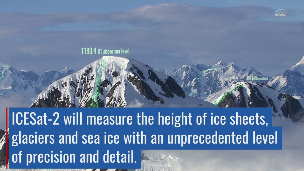
ICESat-2's laser provides data on the height of ice on land and sea, giving scientists data to calculate the ice’s thickness and volume.
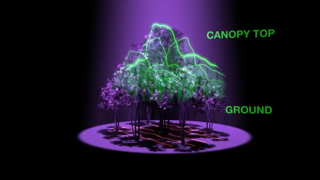
Height data will also be collected on forests across the world, which will help researchers estimate global vegetation.
For More Information
Credits
Please give credit for this item to:
NASA's Scientific Visualization Studio
Non-NASA images listed here with copyright permissions. All photos from government agencies are public domain and only need a credit. For those that require asking the source (i.e. Universities), send copy of email granting permission to ellen.t.gray@nasa.gov
-
Scientists
- Thorsten Markus (NASA/GSFC)
- Thomas A. Neumann (NASA/GSFC)
- Kelly Brunt (Earth System Science Interdisciplinary Center/University of Maryland)
-
Producer
- Ryan Fitzgibbons (USRA)
-
Animators
- Greg Shirah (NASA/GSFC)
- Adriana Manrique Gutierrez (USRA)
-
Writer
- Kate Ramsayer (Telophase)
Release date
This page was originally published on Monday, September 10, 2018.
This page was last updated on Wednesday, May 3, 2023 at 1:46 PM EDT.
Missions
This visualization is related to the following missions:Sources
- ID: 12905
![NASA cryospheric scientist Kelly Brunt and ICESat-2 Deputy Project Scientist Tom Neumann recall some of the highlights and challenges from the recent 88-South Antarctic Traverse.Music: "Lights," Alexius Tschallener [SUISA], Dominik Johnson [PRS]; "Vulnerable Moment," John Ashton Thomas [PRS]Complete transcript available.](/vis/a010000/a012900/a012905/12905_thumbstill_print.jpg) Produced Video
Produced Video - ID: 4455
 Visualization
 - ID: 12663
 Produced Video
 - ID: 11712
 Produced Video
Used as a Source In
- ID: 13124
 Produced Video