NASA Space Laser Heads on a Road Trip
A selection of shots of the ICESat-2 ATLAS instrument leaving Goddard Space Flight Center for Orbital ATK.
Music: "We Learn," Andrew Michael Britton, Atmosphere Music Ltd.
Complete transcript available.
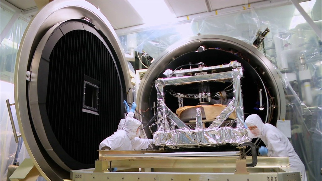
The Ice, Cloud and land Elevation Satellite-2 is slated to launch in September to measure the height of Earth’s surface, particularly the changing polar ice. To do that, it uses a laser instrument called the Advanced Topographic Laser Altimeter System, or ATLAS, that precisely times how long it takes light particles to bounce off Earth and return to the satellite.
ATLAS was designed, built and tested at NASA’s Goddard Space Flight Center in Greenbelt, Maryland. The spacecraft bus, with its solar panels, navigation components and more, was built at Orbital ATK’s facility in Gilbert, Arizona. To deliver the instrument safely to the spacecraft for assembly and testing, the ATLAS team developed special procedures for packing, transporting and monitoring the sensitive hardware.
Credits
Please give credit for this item to:
NASA's Scientific Visualization Studio
-
Producer
- Ryan Fitzgibbons (USRA)
-
Videographer
- Ryan Fitzgibbons (USRA)
-
Editor
- Ryan Fitzgibbons (USRA)
Release date
This page was originally published on Wednesday, February 28, 2018.
This page was last updated on Wednesday, November 15, 2023 at 12:23 AM EST.
Missions
This visualization is related to the following missions:Series
This visualization can be found in the following series:Sources
- ID: 11709