Martian Clues on a Baby Island

A young volcanic island on Earth may hold clues to former islands on Mars.
In late December 2014, a submarine volcano in the South Pacific Kingdom of Tonga erupted, sending a violent stream of steam, ash and rock into the air. The ash plumes rose as high as 30,000 feet into the sky. When the ash finally settled in January 2015, a newborn island with a 400-foot summit nestled between two older islands – visible to satellites in space. The newly formed Tongan island, unofficially known as Hunga Tonga-Hunga Ha'apai after its neighbors, was initially projected to last a few months, washed away by the ocean. But to the surprise of NASA's science team tracking the evolution of the island using monthly, high-resolution satellites observations from the French space agency's Pléades-1A and DigitalGlobe's Worldview satellites, as well as the Canadian Space Agency's RadarSat-2 observations, the island has survived for more than three years. And, it shows a remarkable resemblance to volcanic formations on Mars. Understanding the processes that shape the Tongan island could provide insights into these Martian features which may have formed in in a similarly wet environment – locations ripe for looking for signs of past life.
Learn how a new Tongan island may hold clues to similar volcanic formations on Mars.
Watch the evolution of the new island over the first three years of its life.
The Tongan island has a round shape in the first clear satellite image after it formed, taken January 19, 2015.
Digital elevation map made from satellite data shows the island on April 21, 2015.
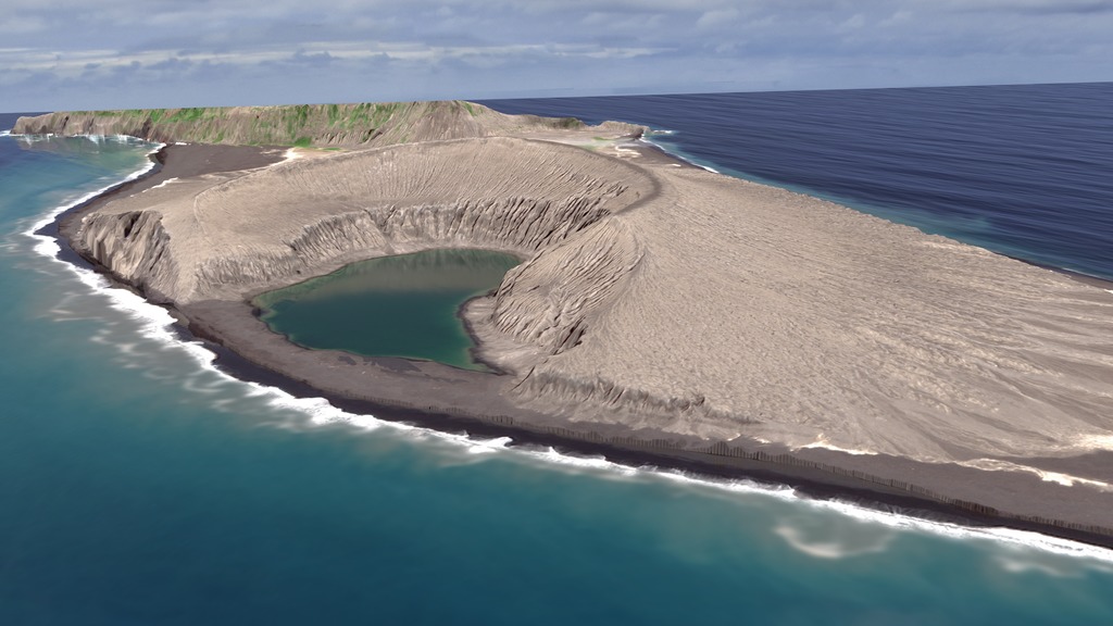
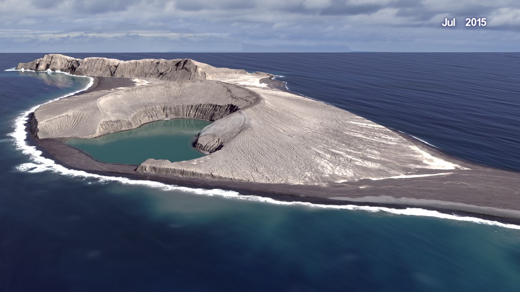
Digital elevation map made from satellite data shows the island on September 19, 2017.
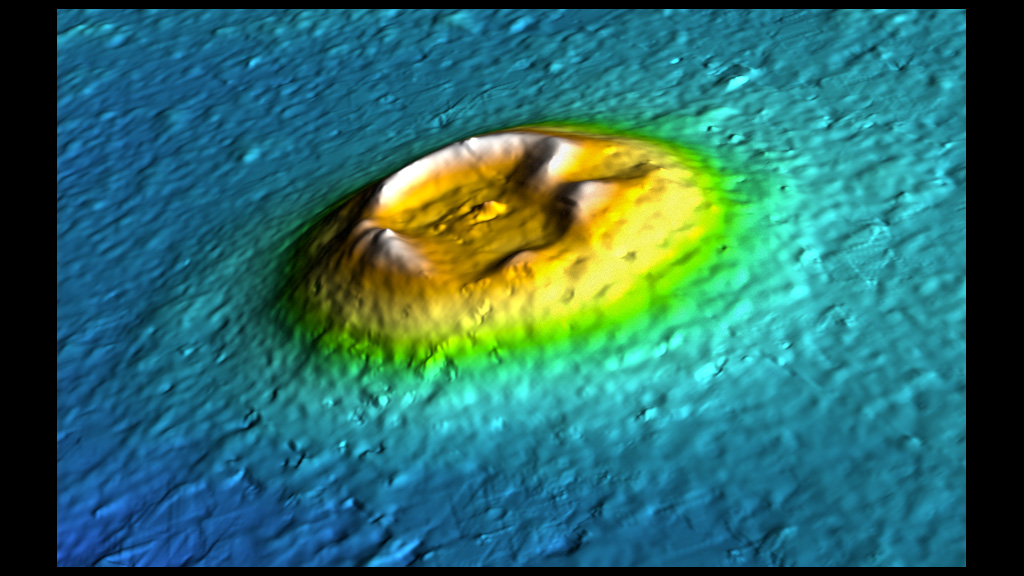
This digital elevation map of a Mars volcano has similarities to the Tongan island that suggest similar processes may have shaped it.
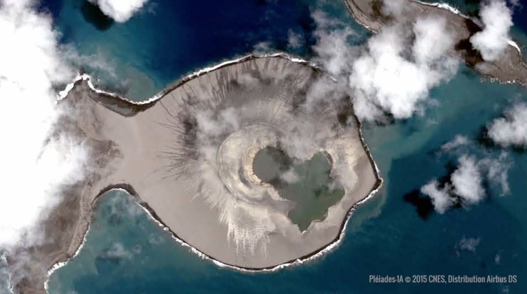
The Tongan island has a crater lake at its center.
The composition of the tephra cliffs that make up the core of the island may explain how the island resists erosion.
For More Information
See NASA.gov
Credits
Please give credit for this item to:
NASA's Scientific Visualization Studio
Satellite image of the Tongan Island courtesy of Pleiades-1A ©2015 CNES Distribution Airbus DS
Photo of the tephra cliffs on the island is courtesy of NASA/Damien Grouille/Cecile Sabau
Mars image courtesy of NASA/JPL/U. Arizona
-
Animator
- Cindy Starr (Global Science and Technology, Inc.)
-
Producer
- LK Ward (USRA)
-
Scientists
- James Garvin (NASA, Chief Scientist Goddard)
- Vicki Ferrini (Lamont-Doherty Earth Observatory, Columbia University)
- Daniel A. Slayback (SSAI)
-
Writer
- Ellen T. Gray (ADNET Systems, Inc.)
Release date
This page was originally published on Monday, May 21, 2018.
This page was last updated on Wednesday, May 3, 2023 at 1:46 PM EDT.
Related
- ID: 4726
 Visualization
 - ID: 4635
- ID: 4602
 Visualization
Alternate Versions
- ID: 12800
 Produced Video