NASA Catches April 1 Nor'easter over New England
The Global Precipitation Measurement mission catches the April 1, 2017, Nor'easter over New England.
Music: "Flowing with Time," Philippe Lhommet, KOKA Media
Complete transcript available.
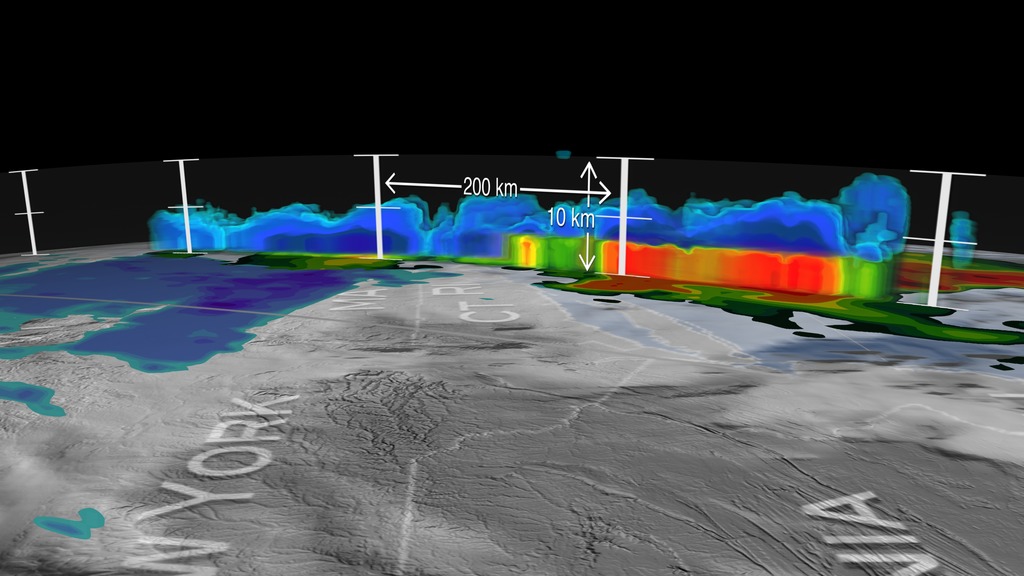
At the time of the Global Precipitation Measurement (GPM) Core Observatory overpass (April 1, 2017, 0550 UTC), the storm's center of low pressure was south of Long Island. At the mid-levels of the atmosphere, the circulation was centered over northeast Pennsylvania. This led to a classic overrunning, warm conveyor setup, which happened when the counterclockwise low level flow drew in cold air out of the north/northeast (hence "Nor'easter") from Canada. Higher up, warm and moist air from further south was lifted over this cold air and resulted in precipitation in the form of snow at the surface. The heavy band of snow that is visible in the GPM data resulted in 8-14 inch totals over southern Maine and New Hampshire, while totals further south in Massachusetts were limited by some mixing with rain.
Credits
Please give credit for this item to:
NASA's Goddard Space Flight Center
-
Producer
- Ryan Fitzgibbons (USRA)
-
Scientists
- George Huffman (NASA/GSFC)
- Stephen J. Munchak (University of Maryland)
- Dalia B Kirschbaum (NASA/GSFC)
-
Visualizer
- Alex Kekesi (Global Science and Technology, Inc.)
Release date
This page was originally published on Monday, April 10, 2017.
This page was last updated on Wednesday, May 3, 2023 at 1:47 PM EDT.
Missions
This visualization is related to the following missions:Series
This visualization can be found in the following series:Sources
- ID: 4570
 Visualization