NASA's Fermi Catches Gamma-ray Flashes from Tropical Storms
Storm clouds produce some of the highest-energy light naturally made on Earth: terrestrial gamma-ray flashes (TGFs). Using data from NASA's Fermi Gamma-ray Space Telescope and ground-based lightning detection networks, scientists tracking these fleeting outbursts are beginning to learn more about how conditions in hurricanes, typhoons and other tropical weather systems set the stage for TGFs.
Credit: NASA's Goddard Space Flight Center
Music: Glacial Fields and The Piper from Killer Tracks.
Watch this video on the NASA Goddard YouTube channel.
Complete transcript available.
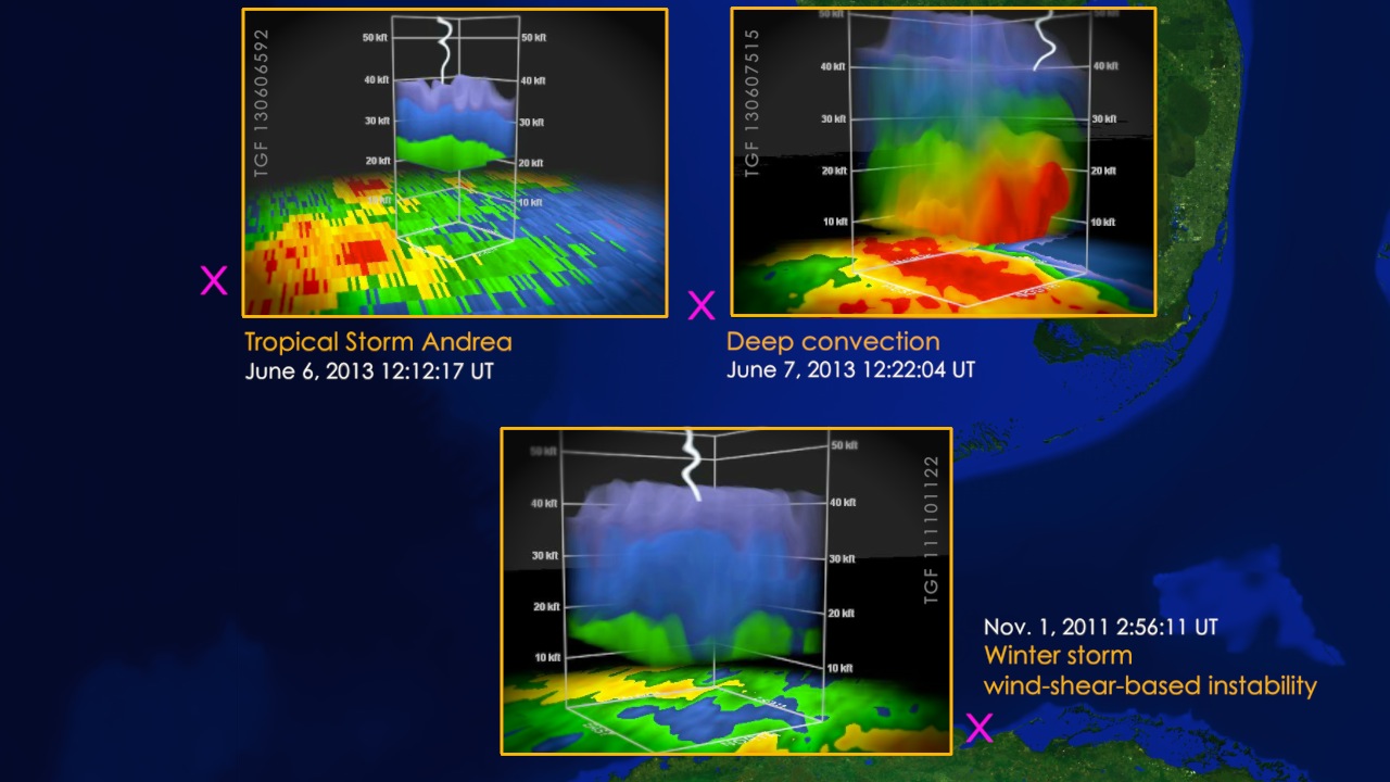
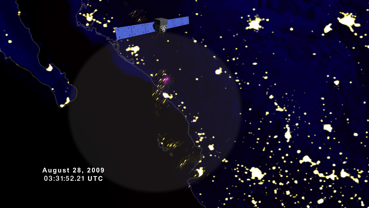
About a thousand times a day, thunderstorms fire off fleeting bursts of some of the highest-energy light naturally found on Earth. These events, called terrestrial gamma-ray flashes (TGFs), last less than a millisecond and produce gamma rays with tens of millions of times the energy of visible light. Since its launch in 2008, NASA's Fermi Gamma-ray Space Telescope has recorded more than 4,000 TGFs, which scientists are studying to better understand how the phenomenon relates to lightning activity, storm strength and the life cycle of storms.
Now, for the first time, a team of NASA scientists has analyzed dozens of TGFs launched by the largest and strongest weather systems on the planet: tropical storms, hurricanes and typhoons.
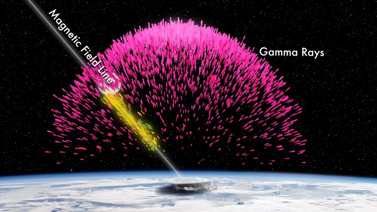
Scientists suspect TGFs arise from the strong electric fields near the tops of thunderstorms. Under certain conditions, these fields become strong enough to drive an "avalanche" of electrons upward at nearly the speed of light. When these accelerated electrons race past air molecules, their paths become deflected slightly. This change causes the electrons to emit gamma rays.
The team studied 37 TGFs associated with, among other storms, typhoons Nangka (2015) and Bolaven (2012), Hurricane Paula (2010), the 2013 tropical storms Sonia and Emang and Hurricane Manuel, and the disturbance that would later become Hurricane Julio in 2014.
What the scientists have learned so far is that TGFs from tropical systems do not have properties measurably different from other TGFs detected by Fermi. Weaker storms are capable of producing greater numbers of TGFs, which may arise anywhere in the storm. In more developed systems, like hurricanes and typhoons, TGFs are more common in the outermost rain bands, areas that also host the highest lightning rates in these storms.
Most of the tropical storm TGFs occurred as the systems intensified. Strengthening updrafts drive clouds higher into the atmosphere where they can generate powerful electric fields, setting the stage for intense lightning and for the electron avalanches thought to produce TGFs.

Hurricane Manuel launched a TGF on Sept. 15, 2013, shortly after it made landfall in the Mexican state of Michoacán (lower inset image). Manuel fired off a second TGF the following day. The magenta symbols mark the TGF locations on satellite images of the storm.
Credit NASA’s Goddard Space Flight Center

During a period of rapid strengthening on Aug. 23, 2012, Typhoon Bolaven launched its only TGF from an outer rain band located nearly 490 miles (785 km) from the storm's center (roughly bottom center of the full image). The Moderate Resolution Imaging Spectroradiometer (MODIS) on NASA’s Terra satellite captured this natural-color image of Bolaven the following day.
Credit: NASA Goddard Space Flight Center/Jeff Schmaltz, LANCE MODIS Rapid Response Team
For More Information
Credits
Please give credit for this item to:
NASA's Goddard Space Flight Center. However, individual items should be credited as indicated above.
-
Producer
- Scott Wiessinger (USRA)
-
Science writer
- Francis Reddy (Syneren Technologies)
Release date
This page was originally published on Monday, April 24, 2017.
This page was last updated on Wednesday, May 3, 2023 at 1:47 PM EDT.


