NASA On Air: 2016 Arctic Sea Ice Minimum Ties Second Lowest On Record (9/15/2016)
LEAD: NASA and the National Snow and Ice Data Center report that the Arctic sea ice minimum ties that of 2007 as the second lowest of the 38 year satellite data record.
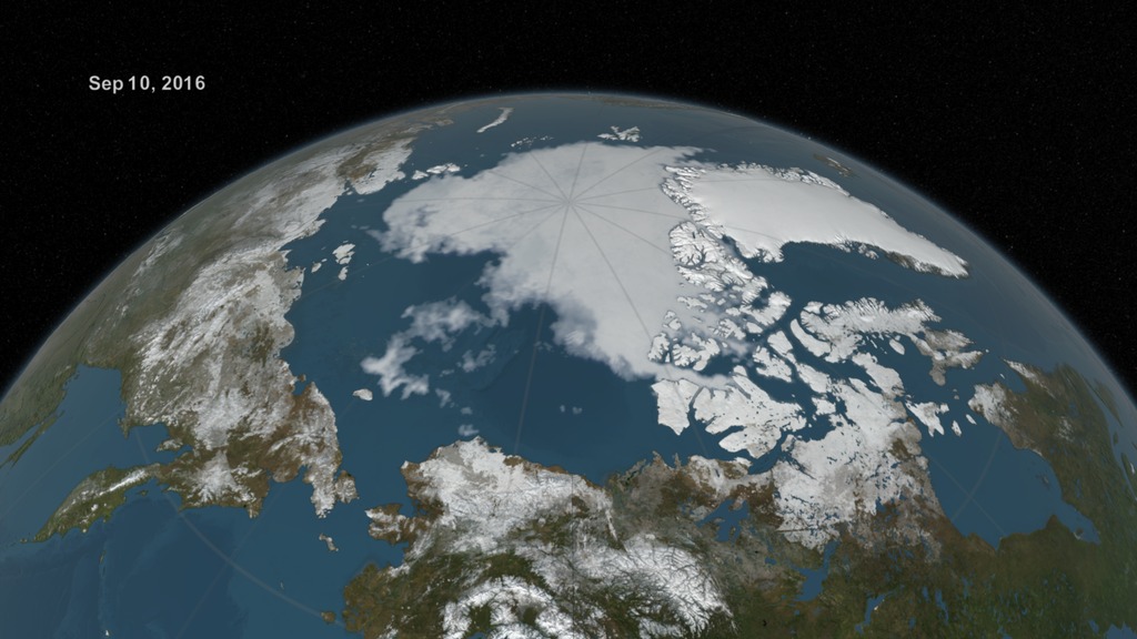
1. The ice extent went down to 1.6 million square miles. This is 0.9 million square miles less than the long-term average from 1981 to 2010.
2. The Arctic ice cover helps regulate the planet's temperature.
3. The yellow outline shows the average sea ice minimum from 1979 through 2010.
TAG: Since 1978 researchers have observed a steep decline in the average extent of Arctic sea ice for every month of the year.
For More Information
See NASA.gov
Credits
Please give credit for this item to:
NASA's Goddard Space Flight Center
-
Producer
- Howard Joe Witte (ADNET Systems, Inc.)
-
Technical support
- Aaron E. Lepsch (ADNET Systems, Inc.)
Release date
This page was originally published on Thursday, September 15, 2016.
This page was last updated on Wednesday, May 3, 2023 at 1:48 PM EDT.
Sources
- ID: 4494
 Visualization