NASA On Air: NASA Satellites Are Tracking Current El Niño Across The Pacific (9/11/2015)
LEAD: NASA's satellites are tracking the developing El Niño across the Pacific Ocean.
-
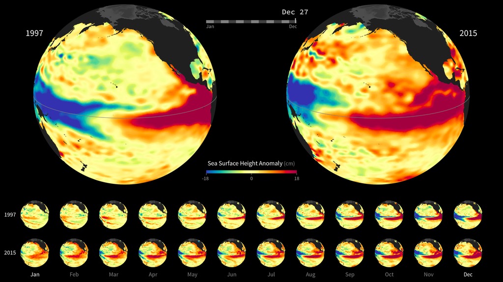
Ocean conditions in 2015 bear some similarities to the powerful 1997 El Niño. This NASA visualization shows side-by-side comparisons of Pacific Ocean sea surface height anomalies measured by satellites in 1997 and 2015.
-
Red shows where the ocean is above the normal sea level.
-
Blue shades indicate areas of lower sea levels.
-
Sea surface height is an indicator of the temperature of the water below. Above normal levels indicate warmer temperatures, below normal colder temperatures.
-
El Niño events are characterized by a mass of warm water migrating from Southeast Asia toward South America.
TAG: Weather and climate forecasters are tracking El Niño closely because it could help steer beneficial rains to parts of drought-stricken California and the American West.
Credits
Please give credit for this item to:
NASA's Goddard Space Flight Center
-
Producer
- Howard Joe Witte (ADNET Systems, Inc.)
-
Video editor
- Sophia Roberts (USRA)
Release date
This page was originally published on Friday, September 11, 2015.
This page was last updated on Wednesday, May 3, 2023 at 1:49 PM EDT.
Related
- ID: 30629
 Hyperwall Visual