Drifting At Sea

An experiment in data visualization explores where research buoys end up in Earth’s oceans.
When a research buoy is released in the ocean, where does it go? In a visualization experiment using ocean buoy data from NOAA's Global Drifter Database, NASA data visualizers depicted the migration of these floating science platforms in Earth's oceans. Over the last 35 years, NOAA has deployed thousands of ocean buoys worldwide. The buoys travel with currents, collecting important measurements of ocean properties like temperature and salinity that scientists use for weather forecasting and verifying observations from Earth-observing satellites. In the visualization, the buoys are seen migratating over time to five known gyres in the ocean where marine debris accumulates, the so-called ocean garbage patches. The visualizers used a computational model of Earth's ocean currents and virtual particles to confirm the result. Watch the video to learn more.
See how research buoys migrate in this video narrated by NASA data visualizer Greg Shirah.
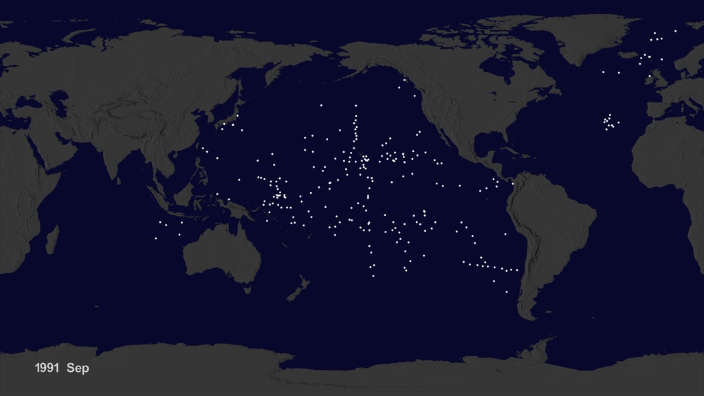
This image shows the start location of more than 17,000 ocean buoys (white dots) deployed by NOAA since 1979.
Once released, ocean currents carry the buoys to different parts of the world.
Observations show a general pattern of the buoys collecting in large rotating currents in the ocean called gyres.
The locations of the gyres coincide with five zones in the ocean, known as garbage patches, where marine debris accumulates.
Credits
Please give credit for this item to:
NASA's Scientific Visualization Studio
-
Animators
- Greg Shirah (NASA/GSFC)
- Horace Mitchell (NASA/GSFC)
-
Project support
- Leann Johnson (Global Science and Technology, Inc.)
- Laurence Schuler (ADNET Systems, Inc.)
- Ian Jones (ADNET Systems, Inc.)
-
Writer
- Greg Shirah (NASA/GSFC)
Release date
This page was originally published on Thursday, October 8, 2015.
This page was last updated on Wednesday, May 3, 2023 at 1:49 PM EDT.
Related
- ID: 4174
 Visualization