Tracking Urban Change With Landsat
For helping communities across the United States stay up-to-date on their flood risk, the NASA/USGS Landsat satellites can take a bow. The Federal Emergency Management Agency uses Landsat images, which can illustrate urban changes, as a key indicator of sites where the agency should further investigate the flooding potential. With its archive of images capturing sprawling cities and new developments, Landsat can help FEMA track how building and construction is impacting an area’s landscape
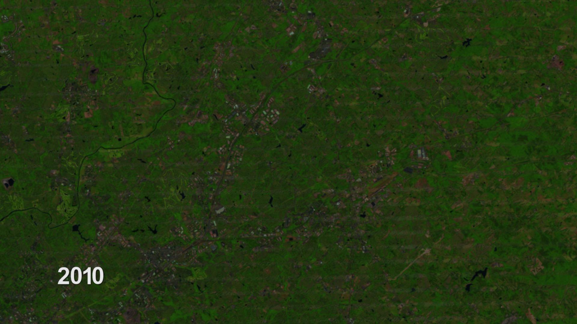
Earth-observing Landsat satellites have been capturing images of the planet’s surface since 1972. Landsat 8 is the newest satellite in the program, a joint effort between NASA and the U.S. Geological Survey. It launched Feb. 11, 2013, and collects more than 400 images per day. New and archived Landsat data are available free to the public over the internet – and researchers have put the data to a multitude of uses. One is called the National Urban Change Indicator, or NUCI, created by MacDonald, Dettwiler, and Associates, LTD. It’s the results from a process that mines Landsat images over a 27-year period to identify areas of “permanent change,” where soil has been paved over for parking lots or other concrete structures.
NUCI results act as a red flag for FEMA, helping the agency focus its mapping efforts and budget. But if maps identify a high risk of floods for a certain community, residents can take action, including elevating houses, building flood barricades, and more.
Landsat data is used by MacDonald, Dettwiler, and Associates, LTD to make the National Urban Change Indicator, or NUCI. The process identifies areas of “permanent change,” where soil has been paved over for parking lots or other concrete structures. Areas of urban change indicate where flood risk maps might need to be updated.
For complete transcript, click here.
Watch this video on the NASA Goddard YouTube channel.
Credits
Please give credit for this item to:
NASA's Goddard Space Flight Center
-
Video editor
- Alison Schuyler Ogden (NASA/GSFC)
-
Interviewee
- Zack Roehr (Dewberry)
-
Narrator
- Alison Schuyler Ogden (NASA/GSFC)
-
Producers
- Matthew R. Radcliff (USRA)
- Alison Schuyler Ogden (NASA/GSFC)
-
Scientist
- James R. Irons (NASA/GSFC)
-
Project support
- Aaron E. Lepsch (ADNET Systems, Inc.)
-
Writers
- Alison Schuyler Ogden (NASA/GSFC)
- Kate Ramsayer (Telophase)
Release date
This page was originally published on Thursday, March 20, 2014.
This page was last updated on Wednesday, May 3, 2023 at 1:51 PM EDT.
Missions
This visualization is related to the following missions:Series
This visualization can be found in the following series:Tapes
This visualization originally appeared on the following tapes:-
FEMA Risk Maps
(ID: 2012118)
Thursday, March 20, 2014 at 4:00AM
Produced by - David Hon (NASA)
Related
- ID: 4062
 Visualization