Sea Ice Update
The cap of floating sea ice that covers the Arctic Ocean melted in the summer of 2012 to its smallest size in nearly 35 years of satellite observations. But as frigid fall and winter temperatures swept over the region, the Arctic seas refroze and the dynamic mass of ice grew again toward its annual peak, reaching it on February 28, 2013. These two seasonal milestones—the Arctic sea ice minimum and maximum—are closely watched by NASA scientists and used as benchmarks of climate change. While the drastic shrinking of the minimum has gained attention in recent years, the maximum has also declined in size but at a slower rate. Still, nine of the 10 smallest maximums in the satellite era occurred in the past decade, with the 2013 maximum ranking as the fifth smallest since 1978. Watch the visualization to see satellite observations of Arctic sea ice from March 2012 through February 2013.

The peak winter extent of Arctic sea ice doesn't cover as much ocean as it once did.
Notice how the extent of Arctic sea ice changes with the seasons.
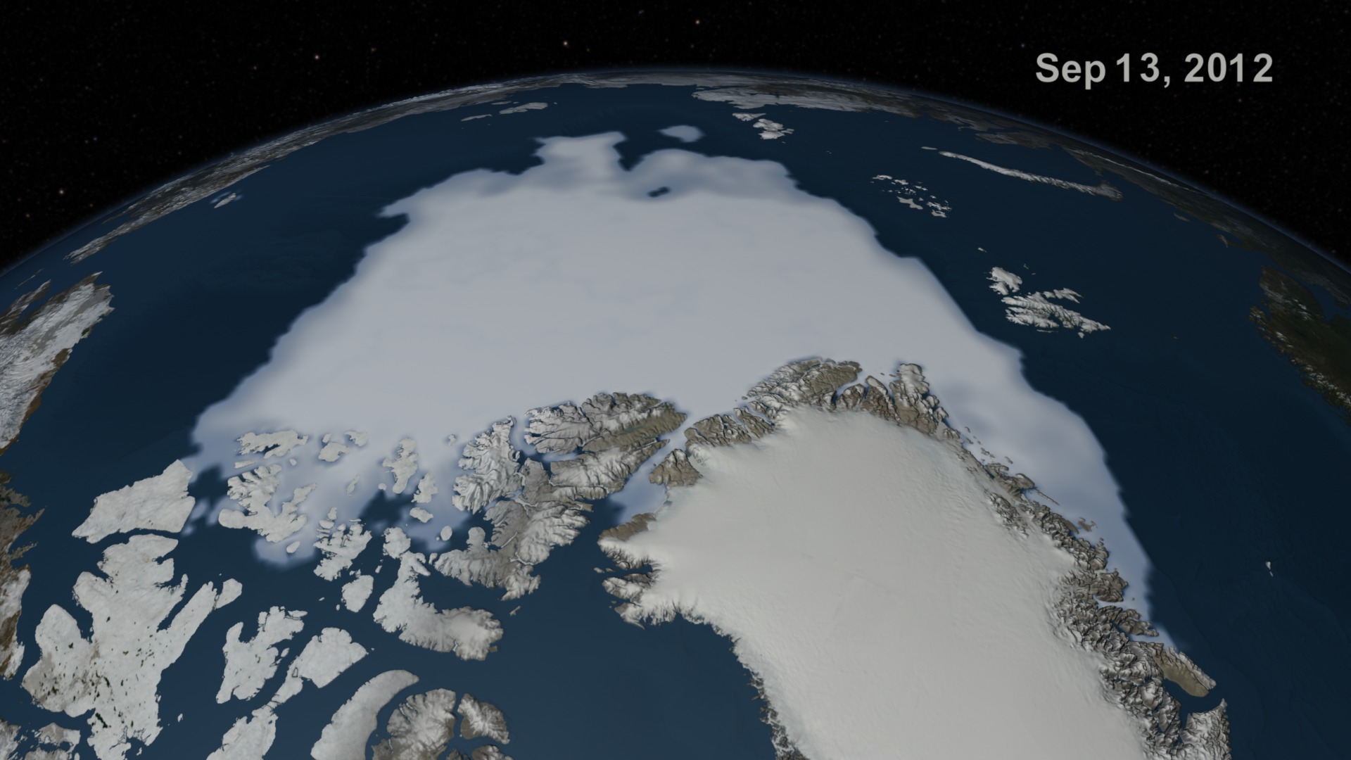
On Sept. 13, 2012, sea ice in the Arctic covered just more than 1.3 million square miles, reaching a new record minimum.
By Dec. 21, 2012, Arctic sea ice was well into its seasonal regeneration, extending south through the islands of northern Canada.
Five months after the record minimum, Arctic sea ice had swelled to cover 5.82 million square miles to reach its annual maximum on Feb. 28, 2013.
For More Information
See NASA.gov
Credits
Please give credit for this item to:
NASA's Goddard Space Flight Center
-
Animator
- Cindy Starr (Global Science and Technology, Inc.)
-
Producer
- Jefferson Beck (USRA)
-
Scientists
- Josefino Comiso (NASA/GSFC)
- Robert Gersten (Wyle Information Systems)
-
Writer
- Patrick Lynch (Wyle Information Systems)
Release date
This page was originally published on Tuesday, April 16, 2013.
This page was last updated on Wednesday, May 3, 2023 at 1:52 PM EDT.
Related
- ID: 4052