Earth At Night
In daylight our big blue marble is all land, oceans and clouds. But the night - is electric.
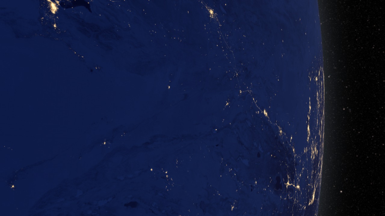
This view of Earth at night is a cloud-free view from space as acquired by the Suomi National Polar-orbiting Partnership Satellite (Suomi NPP). A joint program by NASA and NOAA, Suomi NPP captured this nighttime image by the satellite's Visible Infrared Imaging Radiometer Suite (VIIRS). The day-night band on VIIRS detects light in a range of wavelengths from green to near infrared and uses filtering techniques to observe signals such as city lights, gas flares, and wildfires. This new image is a composite of data acquired over nine days in April and thirteen days in October 2012. It took 312 satellite orbits and 2.5 terabytes of data to get a clear shot of every parcel of land surface.
This video uses the Earth at night view created by NASA's Earth Observatory with data processed by NOAA's National Geophysical Data Center and combined with a version of the Earth Observatory's Blue Marble: Next Generation.
For complete transcript, click here.
For More Information
Credits
Please give credit for this item to:
NASA's Goddard Space Flight Center
-
Animators
- Trent L. Schindler (USRA)
- Robert Simmon (Sigma Space Corporation)
- Jesse Allen (Sigma Space Corporation)
-
Video editor
- Kayvon Sharghi (USRA)
-
Narrator
- Horace Mitchell (NASA/GSFC)
-
Producers
- Kayvon Sharghi (USRA)
- Mike Carlowicz (Sigma Space Corporation)
-
Scientist
- Christopher Elvidge (NOAA/NGDC)
-
Writer
- Aries Keck (ADNET Systems, Inc.)
Release date
This page was originally published on Wednesday, December 5, 2012.
This page was last updated on Wednesday, May 3, 2023 at 1:52 PM EDT.
Missions
This visualization is related to the following missions:Series
This visualization can be found in the following series:Tapes
This visualization originally appeared on the following tapes:-
Earth At Night
(ID: 2012129)
Wednesday, December 5, 2012 at 5:00AM
Related
- ID: 10624
 Produced Video
 - ID: 11146
 Produced Video
 - ID: 4019
 Visualization