Zone Coverage
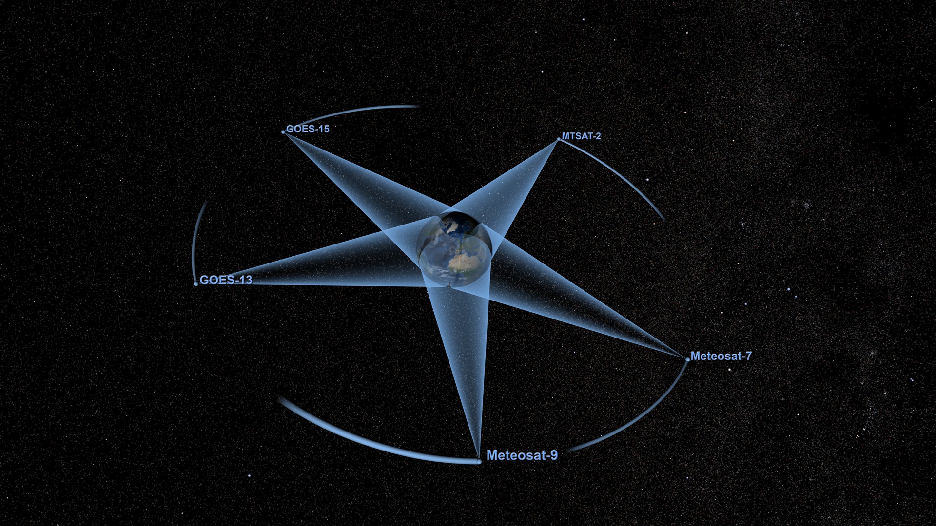
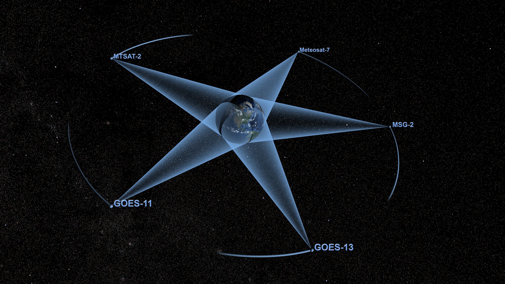
Which satellite watches the weather over your city? If you live in the Western U.S., it's probably GOES-15. On the East Coast it's GOES-13. Traveling at the same speed as Earth's rotation keeps these so-called geostationary satellites perfectly positioned to maintain constant watch over an entire region. A total of five such weather satellites achieve continuous global coverage by orbiting Earth from about 22,300 miles above the equator. At almost one-tenth the distance to the moon, they're farther away than most Earth-observing satellites. But the orbital altitude is anything but arbitrary: too high and the satellite would lag behind Earth's spin, too low and it would outpace its target. Check out the visualization to see how all five weather satellites circle our planet.

Why are weather satellites always in the right place at the right time?
Five weather satellites—GOES-13, GOES-15, Meteosat-7, Meteosat-9 and MTSAT-2—each grant a view of more than a quarter of the planet's surface.
GOES-15 (above) replaced its aging predecessor in orbit over the Western U.S. in 2011.
Meteosat-9 captures the view of weather over Europe and Africa.
GOES-13 tracked Hurricane Sandy along with clouds from a powerful cold front headed toward the East Coast in Oct. 2012.
In this model of tracked space objects (black dots), geostationary satellites form a distinct ring around Earth's equator.
Credits
Please give credit for this item to:
NASA's Goddard Space Flight Center
Meteosat-9 image courtesy of NASA/Rob Simmons using EUMETSAT data
-
Animators
- Helen-Nicole Kostis (USRA)
- Greg Shirah (NASA/GSFC)
- Horace Mitchell (NASA/GSFC)
-
Producer
- Ryan Fitzgibbons (USRA)
-
Scientist
- Eric C. Brown De Colstoun (NASA/GSFC)
-
Writer
- Kathryn Hansen (Wyle Information Systems)
Release date
This page was originally published on Tuesday, October 30, 2012.
This page was last updated on Wednesday, May 3, 2023 at 1:52 PM EDT.
Related
- ID: 4005
 Visualization
 - ID: 3781
 Visualization