Trading Spaces
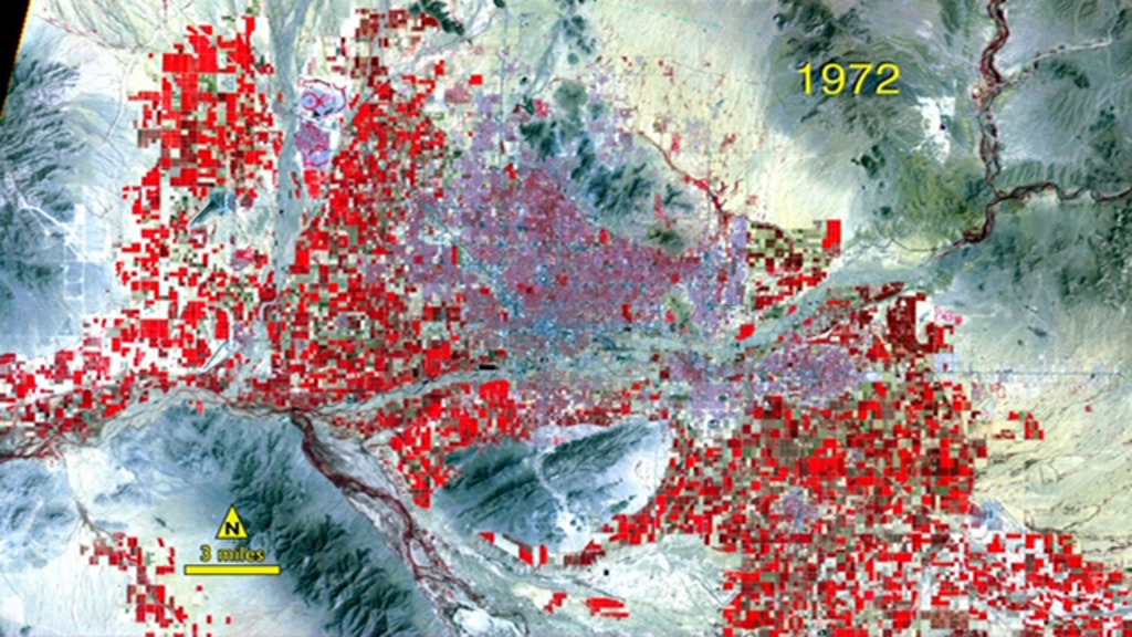
In the last forty years, Phoenix has grown to become one of the most populated places in the United States. The city and its surrounding area currently hold spots on the U.S. Census Bureau's top ten lists of cities and counties, ranking sixth and fourth, respectively. As Phoenix evolved from an agricultural to industrial economy, farmland was pushed to the outskirts in order to make way for suburban developments that stretched southeast and northwest of the city. Between 1974 and 2007, nearly 250,000 acres of agricultural fields were lost. During the same period a fourfold increase in residents brought the region's population to just below the 4 million mark. Witness the transformation of Phoenix in the time-lapse video of false color images captured by USGS-NASA Landsat satellites between 1972 and 2011.

The desert city of Phoenix, Arizona, swaps farms for streets as its population soars.
Healthy vegetation (red) gives way to streets and buildings (purple) as Phoenix grows.
Agricultural plots surround the city center in 1972.
By 2011, widespread development has transformed the landscape.
Salt River is Phoenix's primary water source. In 1985, additional water was brought from the Colorado River to support the growing population.
Impervious surfaces—such as roads, parking lots and rooftops—are colored pink and white in this 1972 satellite image of Phoenix.
The total area of Phoenix covered by impervious surfaces has greatly increased by 2011.
The Landsat Data Continuity Mission satellite is scheduled to launch in Feb. 2013 and will continue Landsat's 40-year-long data record.
For More Information
See NASA.gov
Credits
Please give credit for this item to:
NASA's Goddard Space Flight Center
Landsat is a joint program of NASA and USGS
-
Producer
- Matthew R. Radcliff (USRA)
-
Scientist
- Roger Auch (USGS)
-
Writer
- Ellen T. Gray (ADNET Systems, Inc.)
Release date
This page was originally published on Thursday, August 9, 2012.
This page was last updated on Wednesday, May 3, 2023 at 1:52 PM EDT.
Related
- ID: 11041
 Produced Video