Goodbye, Glaciers
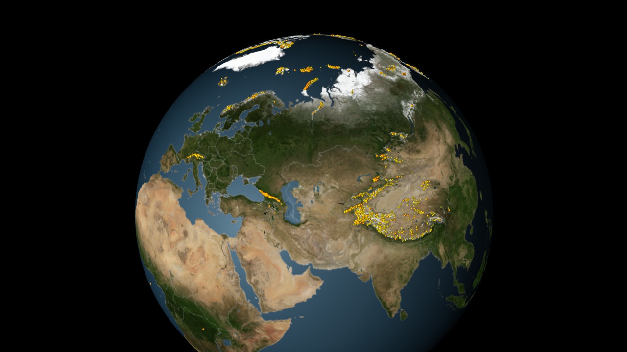
While previous studies have focused on Antarctica's and Greenland's massive ice sheets, this year scientists offered the first detailed estimate of how much all the world's ice deposits are melting and contributing to sea level rise. Using data from NASA's twin GRACE satellites, researchers concluded that Earth has lost a total of 4.3 trillion tons of ice between 2003 and 2010. Greenland and Antarctica lost the bulk of the ice, but nearly a quarter of the losses came from glaciers in Alaska, Canada and Patagonia. The total melting during this period added about half an inch to global sea levels—enough to cover the United States with a layer of water one-and-a-half feet thick. GRACE's inventory of North and South America is shown on a rotating globe in the visualization below, where yellow dots mark the location of individual glaciers and areas with greatest ice loss are shaded purple and blue.

The GRACE satellites offer a new global inventory of the world's melting ice.
In all, about 25 percent of the ice that melted between 2003 and 2010 occurred in North and South America (excluding Greenland).
Islands in northern Canada lost 67 billion tons of ice, 12 percent of the total. (Greenland data not shown)
Southern Alaska lost 46 billion tons of ice per year, 8 percent of the total.
Patagonia lost 23 billion tons of ice per year, 4 percent of the total.
Alaska's Pedersen Glacier photographed during summer 1917 (left) and summer 2005 (right).
Photographs of Alaska's Muir Glacier show the condition of the ice during September 1892 (left) and August 2005 (right).
Credits
Please give credit for this item to:
NASA's Goddard Space Flight Center
1892 Muir Glacier photo courtesy of Harry Fielding, Glacier Photograph Collection, National Snow and Ice Data Center/World Data Center for Glaciology
2005 Muir Glacier photo courtesy of Bruce F. Molnia, Glacier Photograph Collection, National Snow and Ice Data Center/World Data Center for Glaciology
1917 Pedersen Glacier photo courtesy of Louis H. Pedersen, Glacier Photograph Collection, National Snow and Ice Data Center/World Data Center for Glaciology
2005 Pedersen Glacier photo courtesy of Bruce F. Molnia, Glacier Photograph Collection, National Snow and Ice Data Center/World Data Center for Glaciology
-
Animator
- Cindy Starr (Global Science and Technology, Inc.)
-
Narrator
- Erica Drezek (HTSI)
-
Producers
- Kayvon Sharghi (USRA)
- Alan Buis (NASA/JPL CalTech)
- Patrick Lynch (Wyle Information Systems)
-
Scientists
- John Wahr (Department of Physics and Cooperative Institute for Research in Environmental Sciences, University of Colorado at Boulder)
- Thomas Jacob (Department of Physics and Cooperative Institute for Research in Environmental Sciences, University of Colorado at Boulder)
- W. Tad Pfeffer (Institute of Arctic and Alpine Research/Environmental, and Architectural Engineering, University of Colorado at Boulder)
- Sean Swenson (National Center for Atmospheric Research, Boulder)
-
Project support
- James W. Williams (Global Science and Technology, Inc.)
-
Writer
- Adam P Voiland (Wyle Information Systems)
Release date
This page was originally published on Thursday, February 23, 2012.
This page was last updated on Wednesday, May 3, 2023 at 1:53 PM EDT.
Papers used in this visualization
Related
- ID: 3906
 Visualization