A Pinch Of Salt From Space
NASA gave the command last week to power on its newest Earth-observing satellite, Aquarius. It may seem a somewhat peculiar measurement to make, but Aquarius, which launched in June 2011, will measure salinity across all the oceans every week. The data will undoubtedly help answer some of our most pressing questions about climate change. Why measure ocean salinity? The density of ocean water is determined by salinity and water temperature. Density drives the pattern of deep ocean currents, and ocean currents drive global climate. In recent decades, scientists have seen ocean salinity shift in ways that only climate change seems able to explain. Until now, salinity data came from slow-moving ships and a network of floating sensors that could only provide a limited global picture. Satellite technology changes that: From 400 miles (644 km) above Earth Aquarius' hypersensitive microwave radiometer can detect differences in ocean salinity to within a pinch of salt in a gallon of water. Let the science begin.

What does salinity have to do with ocean currents and climate change?
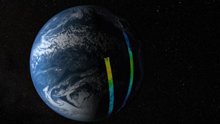
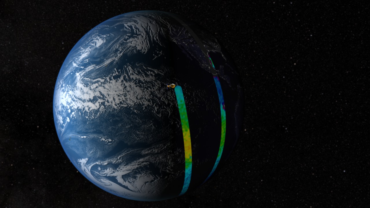
Aquarius' orbit and swath of salinity measurements will provide complete coverage of the oceans every seven days.
The impact of salinity on deep ocean circulation makes it a crucial climate influence to measure.
Rainfall differences make the Atlantic saltier than the Pacific, seen in lighter versus darker areas of this salinity map based on ship data.
Credits
Please give credit for this item to:
NASA's Goddard Space Flight Center
-
Animators
- Alex Kekesi (Global Science and Technology, Inc.)
- Ernie Wright (USRA)
- Greg Shirah (NASA/GSFC)
- Chris Meaney (HTSI)
- Walt Feimer (HTSI)
- Horace Mitchell (NASA/GSFC)
- Helen-Nicole Kostis (UMBC)
-
Video editors
- Brooke Harris (USRA)
- Rich Melnick (HTSI)
-
Narrator
- Erica Drezek (HTSI)
-
Producer
- Brooke Harris (USRA)
-
Scientists
- Gene Feldman (NASA/GSFC)
- Susan Lozier (Duke University)
- David Levine (NASA/GSFC)
- Yi Chao (NASA/JPL CalTech)
- Gary Lagerloef (ESR)
- Fred Patt (SAIC)
-
Project support
- Shiloh Heurich (Global Science and Technology, Inc.)
- James W. Williams (Global Science and Technology, Inc.)
-
Writer
- Patrick Lynch (Wyle Information Systems)
Release date
This page was originally published on Tuesday, August 23, 2011.
This page was last updated on Wednesday, May 3, 2023 at 1:53 PM EDT.
Related
- ID: 11015
 Produced Video
 - ID: 10735
 Produced Video
 - ID: 3830
 Visualization