Racing off the Edge of Greenland
Once known for its size, the Jakobshavn Glacier in Greenland is now studied for its speed. In 1997 Jakobshavn ended a decades-long period of stability as it began to thin, accelerate and eject ice into the sea at a rapid rate. The glacier thinned by as much as 50 feet (15 m) per year between 1997 and 2003, according to NASA laser altimetry measurements, while other Greenland glaciers were thinning by about three feet (1 m) per year. The glacier now moves at more than nine miles (15 km) per year, doubling its speed from a decade ago. The glacier's calving front has retreated more than six miles (10 km) in the past decade alone. Scientists point to several warming-related causes for the increase in speed and retreat: meltwater can trickle through cracks in the ice and lubricate the friction point between ice and bedrock, and warmer ocean waters underneath the ice shelf also cause thinning. The thinner ice shelf and meltwater reduce resistance to glacier movement. As a glaciology case study and the greatest potential contributor to sea level rise in the Northern Hemisphere, scientists will continue to watch Jakobshavn closely.

Draining as much as 10 percent of Greenland's land ice, this speedy glacier has scientists' attention.
Jakobshavn's leading edge accelerated its landward retreat suddenly and rapidly beginning in 1997.
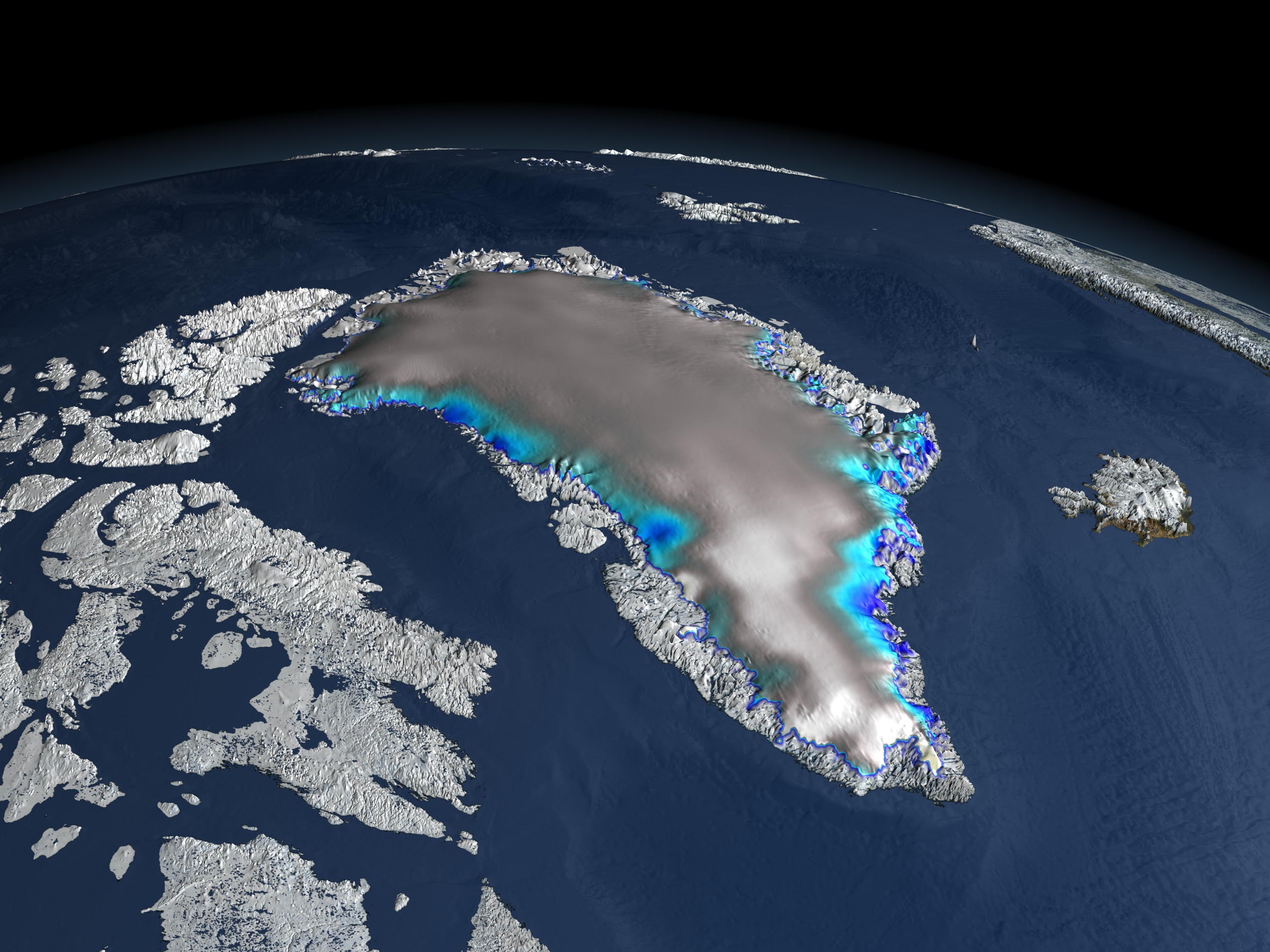
NASA laser altimetry data shows changes in elevation from 2003 to 2006. Light and dark blues indicate ice thinning.
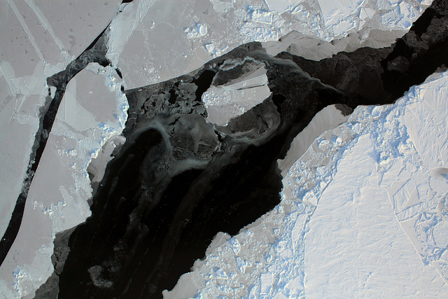
A laser scan, collected during NASA's Operation IceBridge in 2010, maps icebergs broken off from Jakobshavn's 270-foot-tall calving front.
NASA scientists captured this aerial photo of Jakobshavn's calving front in 2010.
From a different angle, the calving front towers over the pack ice that has separated from the glacier.
Credits
Please give credit for this item to:
NASA's Goddard Space Flight Center Scientific Visualization Studio
Image of 3D scan of Jakobshavn calving front courtesy of NASA's Airborne Topographic Mapper team
Photographs of Jakobshavn calving front courtesy of NASA's Digital Mapping System team
-
Animator
- Cindy Starr (Global Science and Technology, Inc.)
-
Writer
- Patrick Lynch (Wyle Information Systems)
Release date
This page was originally published on Tuesday, August 16, 2011.
This page was last updated on Wednesday, May 3, 2023 at 1:53 PM EDT.
Related
- ID: 12335
 Produced Video
 - ID: 3806

- ID: 3619
 Visualization
 - ID: 3460
Alternate Versions
- ID: 12178
 Produced Video