Earth
ID: 2640
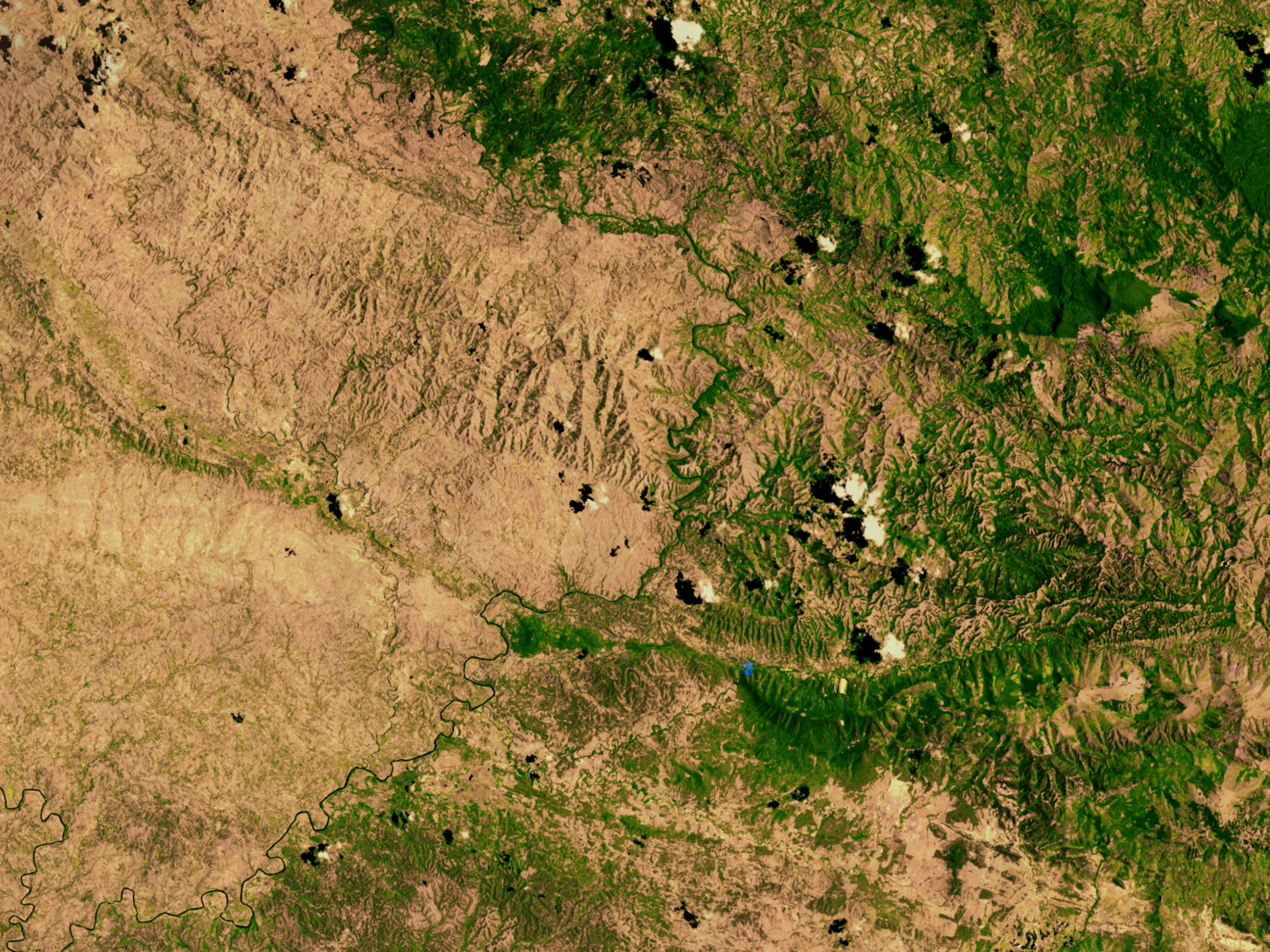
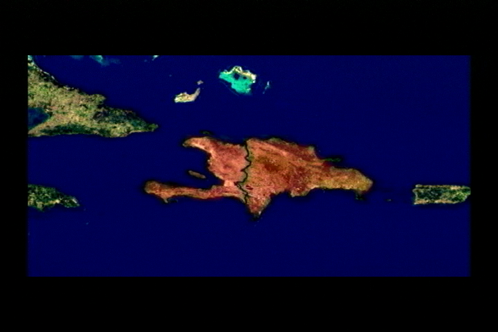
The border between Haiti and the Dominican Republic (D.R.) is more than just a political boundary. It also reflects the large amount of deforestation that has occurred on the Haitian side of the border. One can easily see from satellite imagery the lush forests still thriving on the D.R. side of the border, which is in sharp contrast to the Haitian side of the border.
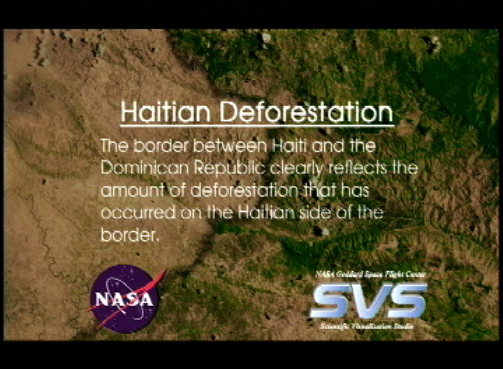
Haitian Deforestation
Visualization Credits
Alex Kekesi (Global Science and Technology, Inc.): Lead Animator
Darrel Williams (NASA/GSFC): Scientist
Darrel Williams (NASA/GSFC): Scientist
Please give credit for this item to:
NASA/Goddard Space Flight Center Scientific Visualization Studio
NASA/Goddard Space Flight Center Scientific Visualization Studio
Short URL to share this page:
https://svs.gsfc.nasa.gov/2640
Missions:
Landsat
Terra
Data Used:
Note: While we identify the data sets used in these visualizations, we do not store any further details nor the data sets themselves on our site.
This item is part of this series:
Journey to Planet Earth
Keywords:
GCMD >> Location >> Dominican Republic
GCMD >> Location >> Haiti
NASA Science >> Earth
GCMD keywords can be found on the Internet with the following citation: Olsen, L.M., G. Major, K. Shein, J. Scialdone, S. Ritz, T. Stevens, M. Morahan, A. Aleman, R. Vogel, S. Leicester, H. Weir, M. Meaux, S. Grebas, C.Solomon, M. Holland, T. Northcutt, R. A. Restrepo, R. Bilodeau, 2013. NASA/Global Change Master Directory (GCMD) Earth Science Keywords. Version 8.0.0.0.0
https://svs.gsfc.nasa.gov/2640
Missions:
Landsat
Terra
Data Used:
Landsat-5/TM
05/13/1998Terra/MODIS
04/24/2001-07/28/2001Landsat-5/TMI/Band Combination 5, 4, 2
05/13/1998This item is part of this series:
Journey to Planet Earth
Keywords:
GCMD >> Location >> Dominican Republic
GCMD >> Location >> Haiti
NASA Science >> Earth
GCMD keywords can be found on the Internet with the following citation: Olsen, L.M., G. Major, K. Shein, J. Scialdone, S. Ritz, T. Stevens, M. Morahan, A. Aleman, R. Vogel, S. Leicester, H. Weir, M. Meaux, S. Grebas, C.Solomon, M. Holland, T. Northcutt, R. A. Restrepo, R. Bilodeau, 2013. NASA/Global Change Master Directory (GCMD) Earth Science Keywords. Version 8.0.0.0.0


