Torrential Atmospheric Rivers

After four years of drought, atmospheric rivers deliver rain to California.
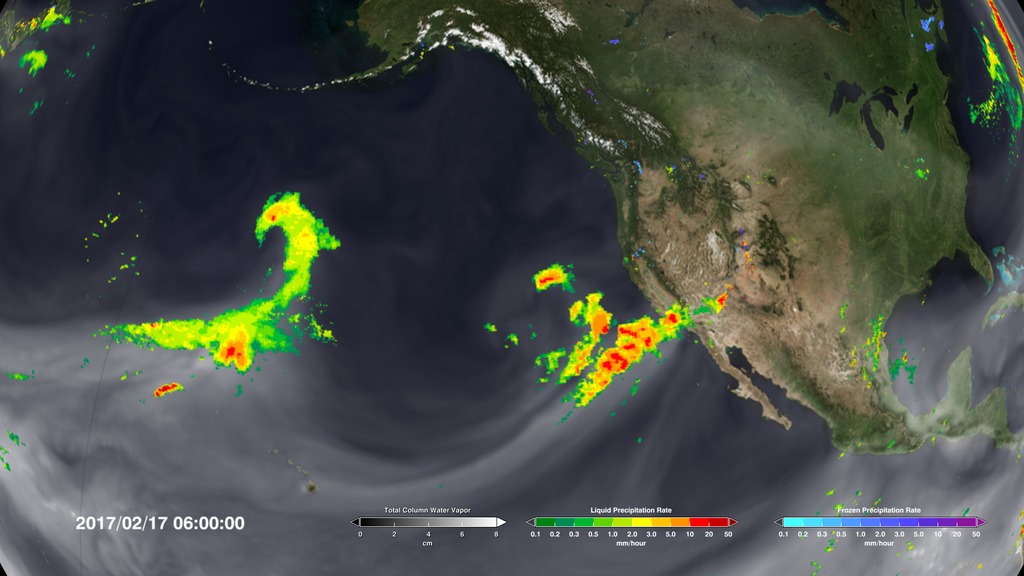
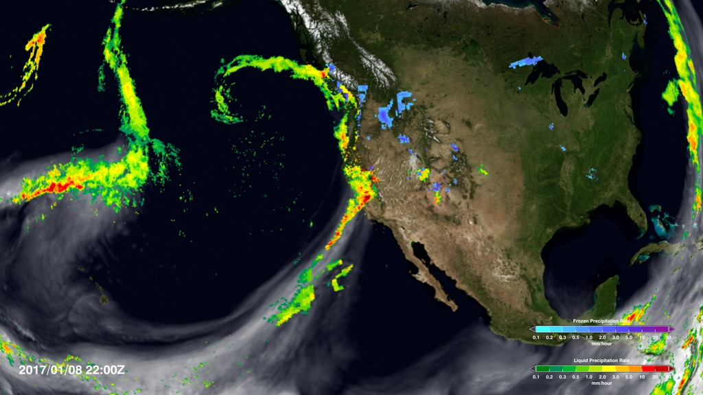
A series of atmospheric rivers delivered record amounts of rainfall to California and the American West this winter, breaking the drought that has gripped the region since 2012. The deluge is fed by long tendrils of water vapor that build up over the ocean – atmospheric rivers – that then turn into rain when they approach and pass over the coast. Rain data shown in green to red from NASA's Global Precipitation Measurement (GPM) mission and water vapor data, in white, from the Goddard Earth Observing System Model (GEOS) show the extreme rainfall that occurred in California during February, 2017, and the atmospheric rivers that transported the rain to the area. Watch the videos to see the rain arrive.
Watch a series of atmospheric rivers slam California during February, 2017.
Atmospheric rivers occur all over the world in this global view from February, 2017.
This natural color satellite image taken by Suomi NPP on Feb. 20, 2017, shows the atmospheric river stretching from Hawaii to California.
The U.S. west coast accumulated 2-3 inches of rainfall between Feb. 15-21, 2017.
For More Information
Credits
Please give credit for this item to:
NASA/Goddard Space Flight Center Scientific Visualization Studio
VIRRS Suomi NPP natural color image courtesy of NASA/Earth Observatory/Jesse Allen.
Rain Accumulation map courtesy of NASA/Hal Pierce.
-
Animator
- Horace Mitchell (NASA/GSFC)
-
Scientist
- Duane Waliser (NASA/JPL CalTech)
-
Writer
- Ellen T. Gray (ADNET Systems, Inc.)
Release date
This page was originally published on Monday, February 27, 2017.
This page was last updated on Wednesday, May 3, 2023 at 1:47 PM EDT.
Sources
- ID: 4555
 Visualization
 - ID: 4547
 Visualization