NASA On Air: NASA's GPM Satellite Tracks Rain For Farmers Around The World (4/28/2016)
LEAD: A network of Earth-observing satellites is helping to track crop growing conditions around the world.
-
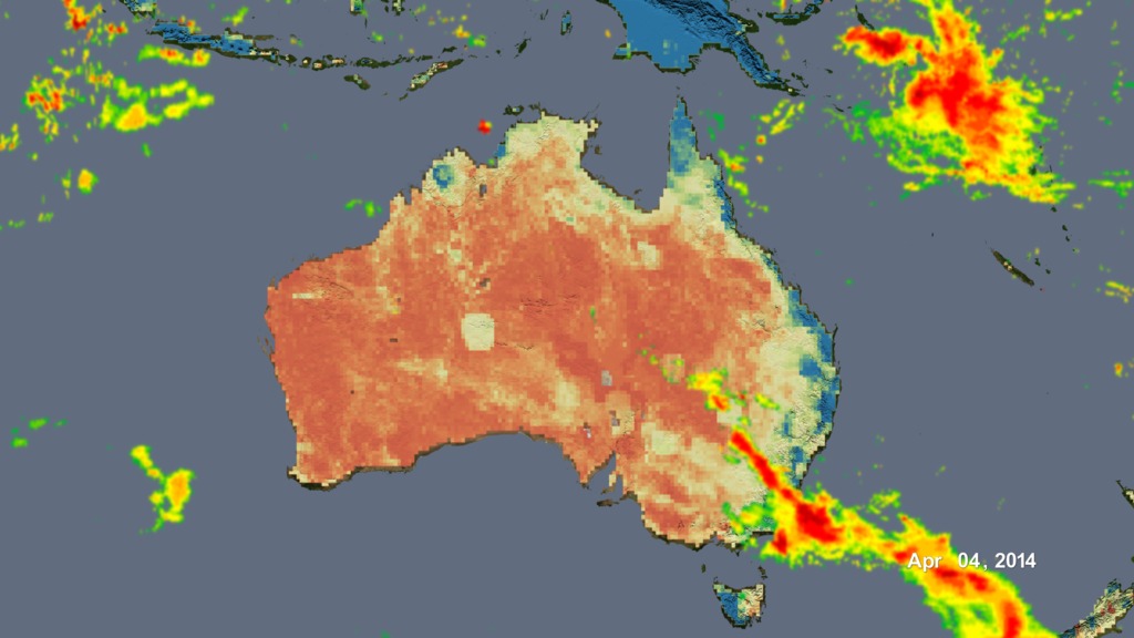
Rainfall, shown here as radar-like moving bands of reds and yellows, can now be tracked every 30 minutes across most of the earth.
-
The base maps of the continents change color indicating the available moisture (water) in the surface soils for growing crops.
-
This information is especially helpful to farmers waiting for the summer monsoon rain in countries such as India that only have limited number of weather stations.
TAG: The data is already being used by the USDA Foreign Agricultural Service.
For More Information
See www.nasa.gov/GPM
Credits
Please give credit for this item to:
NASA's Goddard Space Flight Center
-
Producer
- Howard Joe Witte (ADNET Systems, Inc.)
-
Video editor
- Sophia Roberts (USRA)
-
Technical support
- Aaron E. Lepsch (ADNET Systems, Inc.)
Release date
This page was originally published on Wednesday, April 27, 2016.
This page was last updated on Wednesday, May 3, 2023 at 1:48 PM EDT.
Missions
This visualization is related to the following missions:Related
- ID: 4443
 Visualization