25 Years of Forest Dynamics
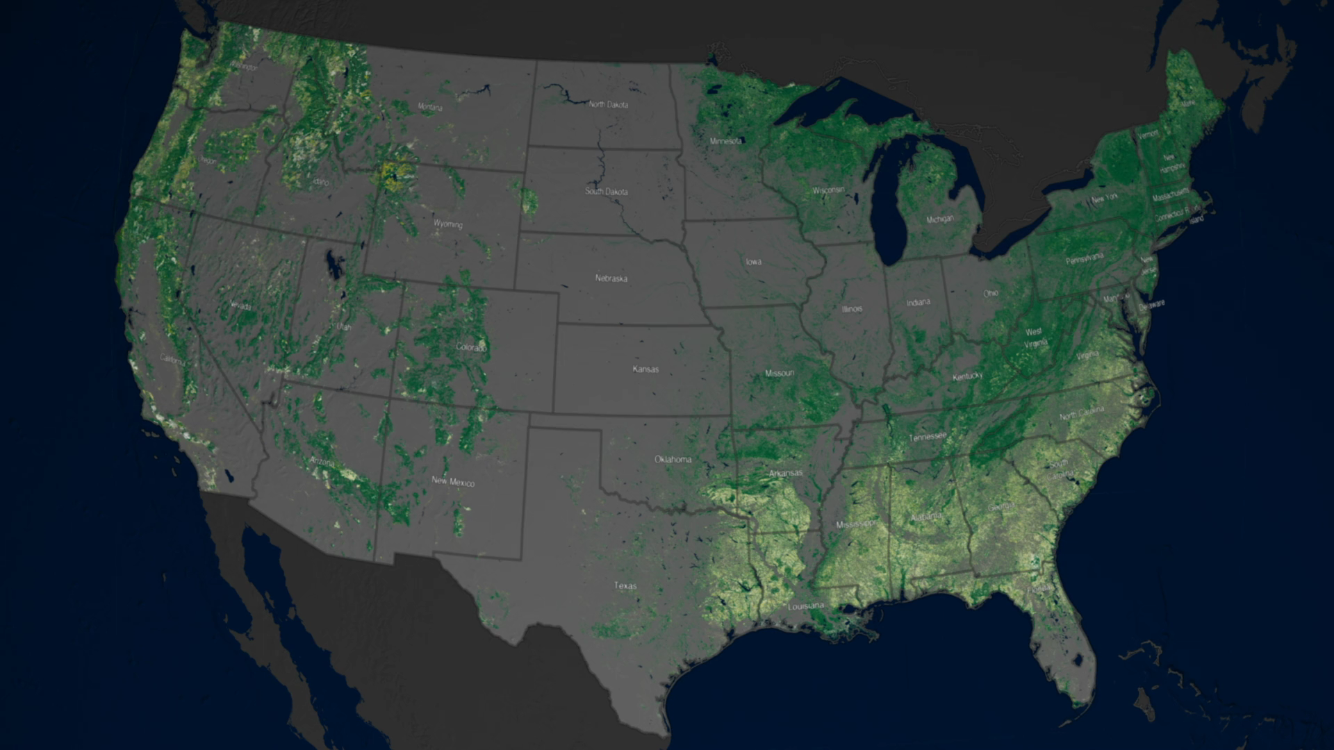
Annual maps of the lower-48 United States produced from Landsat data illustrate how forests changed from 1986-2010. Logging and hurricanes play a significant role in the Southeast, and fires and insect invasion damage forest canopy in the West.
Complete transcript available.
Music credit: Dusk On The Plains by B. Boston
Watch this video on the NASA Goddard YouTube channel.
Forests are living, ever changing ecosystems, affected by aging, natural disasters and human interventions.
Annual maps of the lower-48 United States produced from satellite data illustrate how these dynamic systems changed from 1986-2010. Logging and hurricanes play a significant role in the Southeast, and fires and insect invasion damage forest canopy in the West.
Trees are one of the world's best absorbers of atmospheric carbon dioxide, a greenhouse gas. Understanding how trees and forests change through time is one of the first steps to understanding how active they are in pulling carbon dioxide out of the atmosphere, which is of profound interest to scientists monitoring climate change.
Developed for the North American Forest Dynamics study, scientists combined 25 years of satellite data from the joint U.S. Geological Survey/NASA Landsat satellite program with information from the U.S. Forest Service to highlight where forest canopy was disturbed.
To learn more about the project and get data, visit: https://daac.ornl.gov/NACP/guides/NAFD-NEX_Forest_Disturbance.html
A web video with no narration that showcases the North American Forest Dynamics (NAFD) study including the visualizations that show forest loss from a mountain pine beetle outbreak, a hurricane, mining, and wildfires.
Music credit: Drifting Clouds by Andrew Britton.
Short clip from longer video on US forest dynamics. This section shows forest disturbance across the contiguous United States from 1986-2010. Dark green pixels had no disturbance during those years. Yellow shows where a disturbance happened in a particular year.
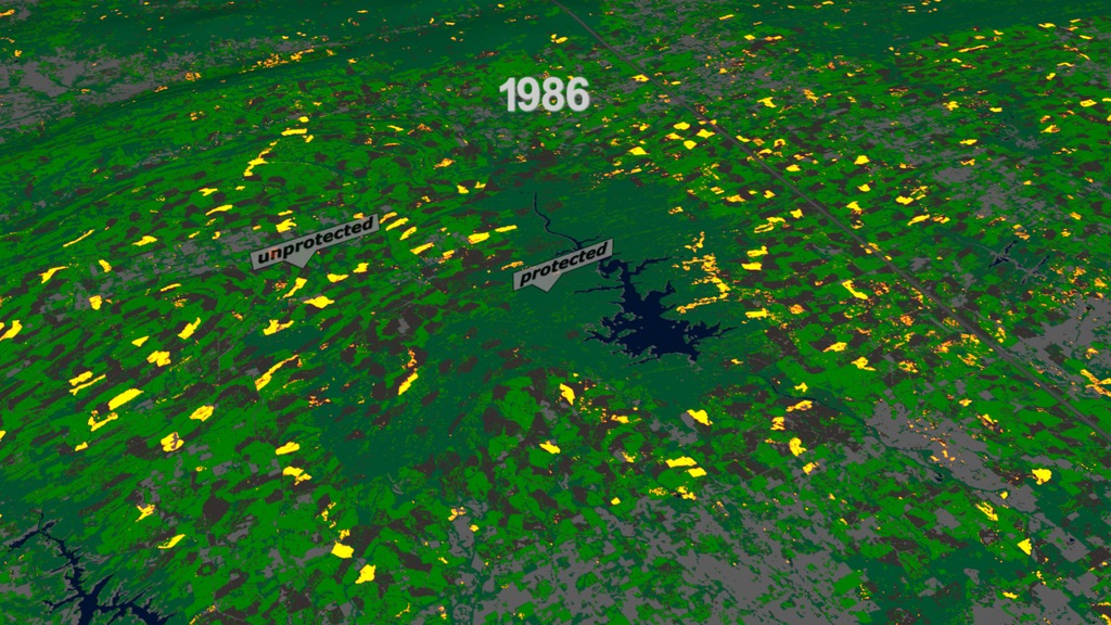
Short clip from longer video on US forest dynamics. Protected areas around Broken Bow Lake in southeast Oklahoma remain largely undisturbed compared to the surrounding region, which flickers with the tell-tale patches of timber harvesting.
Short clip from longer video on US forest dynamics. This section shows the spread of the Hobet Mine in Boone County, West Virginia.

Short clip from longer video on US forest dynamics. Hurricane Hugo knocked down trees across four and a half million acres when it made landfall in South Carolina in September of 1989. The disturbance of the forest is visible in the 1990 data.
Short clip from longer video on US forest dynamics. On Mother's Day, 2008, several tornadoes in Georgia left a track 150 kilometers long and about 2 kilometers wide.
Short clip from longer video on US forest dynamics. This shows spread of damage from Mountain Pine Beetles in northern Colorado (near Rocky Mountain National Park) from 2003-2007.
Credits
Please give credit for this item to:
NASA's Goddard Space Flight Center
-
Producers
- Matthew R. Radcliff (USRA)
- Joy Ng (USRA)
-
Animator
- Greg Shirah (NASA/GSFC)
-
Scientists
- Jeffrey Masek (NASA/GSFC)
- Chengquan Huang (University of Maryland)
- Feng Zhao (University of Maryland)
-
Writers
- Jeffrey Masek (NASA/GSFC)
- Matthew R. Radcliff (USRA)
Release date
This page was originally published on Friday, April 27, 2018.
This page was last updated on Wednesday, May 3, 2023 at 1:46 PM EDT.
Missions
This visualization is related to the following missions:Series
This visualization can be found in the following series:Related
- ID: 4399
Used as a Source In
- ID: 12419
 Produced Video